6.1. Justification of Part 1 Policies
6.1.1. Investment in highway infrastructure has traditionally and mainly been
geared towards the expansion of highway capacity in order to reduce road
congestion, and to meet forecasts of increased growth in road traffic. This
“predict and provide” approach to highway development is now generally agreed to
be unsustainable. It is nationally recognised that road building alone cannot
solve the problem of traffic growth and increasing road congestion, and that
where such new construction is deemed to be necessary, it should be justified by
other factors, rather than to aim to cater solely for predicted increases in
traffic.
6.1.2. Similarly, it is now also generally acknowledged that while new
construction of roads may create extra highway capacity, this will not, in
itself, solve all of the problems caused by traffic congestion. Other more
environmentally acceptable measures, such as a physical reduction in highway
capacity, should be considered in addressing the issues involved. The Council
recognises that by pursuing this approach, which is justified on economic and
environmental grounds, some cars may be displaced, especially during peak
periods, with initial inconvenience to their users. Such losses would, however,
be mitigated by the further provision of priority measures to aid efficient
movement of buses, cyclists and pedestrians, thereby supplementing progress
which has already been made on pedestrianisation plans, cycle and community
routes and providing safe routes to schools in the County Borough, whilst
encouraging modal shift, and improving the local environment. In this respect,
the Council is confident that the overall impact of its transportation policies
will be to the social, economic and environmental benefit of all residents of
the County Borough.
6.1.3. The Council recognises that capacity adjustments to the highway
network will have an impact on transport costs, journey to work patterns,
economic development (including proposed changes to retail deliveries and
loading restrictions), and therefore the future location of land-uses. Decisions
to adjust or re-allocate highway capacity will therefore need to be informed by
the role that public transport infrastructure, especially rail, will play in
improving the overall efficiency of the total transport network.
6.1.4. While it may be generally desirable to constrain highway capacity in
some areas of the County Borough to discourage the use of the car, in other
areas, there may be a compelling need to enhance the highway network through
new-build or highway improvements. In appropriate instances, new road
construction can stimulate economic opportunities and developments by attracting
inward investment, as formerly occurred in the M4 motorway corridor. The
resultant potentially positive impacts of regeneration also justify keeping the
option of building certain new roads, especially in those areas where
attractive, environmentally acceptable development land is genuinely available.
It is for these reasons, that
Policy 6 has been introduced into the Plan.
6.1.5. The type, quality, and level of infrastructure in the County Borough
will influence modal choice of transport, and the nature of proposed
development. In their turn, the latter factors will influence the operational
performance of existing transport and highway infrastructure, future investment
requirements, and any implementation programme. It is in this context that
Policy 7 is introduced.
6.1.6. To pursue the aim of co-ordinating and integrating land use with
transport provision, thereby reducing journey lengths and reliance on the use of
cars while enhancing rail freight potential, the highway network must be managed
with a view to reinforcing the economic, social and environmental benefits
deriving from the developments it will serve. It is therefore necessary to
formulate transportation policies that will influence the location and nature of
development by, for example, encouraging mixed-use developments at locations
close to public transport corridors. This approach also embodies a reduction in
the number and length of journeys, particularly those by car. It will similarly
enhance and encourage journeys by public transport, cycle or on foot, thereby
making more efficient use of the whole transportation network and reducing
environmental degradation. Such an approach is embodied in the UDP’s strategy
which promotes multi-modal transport corridors at the core of the transportation
network.
6.1.7. To assist in the above process, and in consultation with the public
and other local authorities in the South Wales region, the Council is proposing
revised parking standards which will determine and regulate the level of parking
provision in new developments. The requirement to apply maximum parking
standards, as advised in Planning Policy Wales 2002, forms the basis for
that work. Again, the basic tenet being: to reduce the reliance on cars and
encourage the use of public transport, especially in areas where the latter is
already amply provided, or where the potential exists for its further promotion.
6.1.8. Therefore, to achieve the aims and objectives of the revised
standards, the Council will introduce policies requiring developers to submit,
as a part of their development proposals, an assessment of public transport
accessibility and provision for cycling and pedestrian facilities. Similarly,
the Council will also require developers of all future proposals for
employment-generating activities/uses to submit ‘commuting or travel plans’
which must be accompanied by a full explanation of how their plans will assist
in delivering efficiency in the local transport network.
6.1.9. The Council is also aware that there may be instances where a
developer’s proposals, when implemented, would have an adverse impact on the
transport network and the local environment. Where this will occur, the
developer(s) in question will be required to introduce the appropriate measures
to rectify it. All of the above assessments/plans will be closely scrutinised by
the Council and be subject to its approval.
6.1.10. Management of the transportation network, and future investment
decisions are each influenced by, among other things, the efficient movement of
people and goods. Whereas movement of goods nationally by road has been
increasing, the rail industry’s share of freight traffic has remained constant
over recent years. However, the structure of the economic and industrial output
of the County Borough suggests that significant potential exists for a share of
that freight traffic to be harnessed by rail in the interests of the economic
and environmental benefit of the area. Therefore, to encourage local movement of
freight by rail, the Council will favour development proposals which aim to
locate at appropriate sites which will facilitate rail-freight movements. Such
developments may also attract assistance under Section 249 of the
Transport Act 2000.

Part 2
6.2. Introduction
6.2.1. Transportation is a vital instrument in securing the economic,
environmental and social well-being of the County Borough. The nature of the
transportation network can significantly influence the location, type and scale
of development, and the means by which it should be accessed; and, conversely,
the operational performance of that network and future requirements are
themselves influenced by land-use developments. It is the recognition of these
relationships that forms the basis of national guidance, and which therefore
advocates the integration of land-use and transportation planning.
6.2.2. Historically, land-use patterns in Bridgend County Borough have been a
significant factor in the local provision of housing, employment, shopping,
educational and leisure facilities. Hence, the number and lengths of journeys
have increased, and there has been an increased reliance on travel by cars. This
trend was encouraged by minimum car parking standards and highway network
management priorities, each of which has acted to the detriment of public
transport and other modes of travel.
6.2.3. The decline in the use of public transport, however, cannot be
attributed only to a rise in the use of cars and past concentration of
development at the periphery of urban settlements, as it has also been
significantly influenced by inadequate integration of different transport modes
and poor linkages with developments. This has also contributed to social
inequality. For example, out-of-town retailing and employment areas were
originally served by only limited public transport provision, and/or the
frequency of services could not sustain or support convenient work-related
journey patterns by modes other than the car itself. In these circumstances,
households which were unable to own or have access to the use of a car, became
socially excluded from the economic benefits provided by those developments i.e.
jobs or reduced prices.
6.2.4. The social and environmental costs that such exclusion imposes on the
County Borough tend to reduce the beneficial effects of an improved
transportation network. It is therefore the aim of the Unitary Development Plan
(UDP) to formulate policies to reduce these costs, and thereby reduce social
exclusion as a constituent aim in achieving sustainable development.
6.2.5. The transport problems within the County Borough are varied and
diverse as there is no uniformity in provision of transport services and equal
availability of modal choice. This is clearly demonstrated by the existing
highway network north and south of the M4, and the contrasting socioeconomic
characteristics of the County Borough.
6.2.6. Some unique rural transport problems are also evident, such as
inadequate public transport facilities and less generous access to amenities,
which should not be subsumed in the overall concern to resolve urban transport
problems (such as congestion), through fiscal initiatives, traffic restraint and
other demand management measures.
6.2.7. To address the varying and diverse transport needs of the County
Borough therefore requires a flexible package of integrated transport measures
that will ease movement, and provide equitable access for all residents. This
will include measures for traffic management and restraint, cycling, pedestrian
and bus priority. Notwithstanding the reduced emphasis on new road building,
however, it will be necessary for this integrated transport package to include a
degree of new road construction, together with some improvements to existing
highways, to meet the overall challenge.
6.2.8. However, the Council’s transport strategy also takes on board the
advice provided in Planning Policy Wales 2002, which sets out the
framework for the promotion of integrated transport in the delivery of
sustainable development objectives. The guidance recognises the need to
constrain the continuing rise in car use and the growth in overall traffic
levels, but also the inability to continue to provide for forecast demand due to
the prohibitive social and financial costs of road building. Hence the guidance
requires that integrated transport policies should be developed to contribute
towards reducing the rate of growth in traffic, reducing the increasing reliance
on cars, while encouraging the use of alternative modes of transport.
6.2.9. The need to reduce the increasing reliance on cars, will encourage
developers to choose sites for development which will be well-served by public
transport, with reduced required parking provision, and thereby support the
sustainable aims of the UDP. Detailed guidance supporting the above aims for
integrated land-use and transport planning is contained in Planning Policy
Wales 2002 which promotes the relevant precepts set down in the
Road Traffic Reduction Act 1997.
6.2.10. To recognise further the reduced emphasis on road construction as the
major element of transport investment, the government has made Local Transport
Plans (LTPs) the central focus for delivering its objectives of integrated
transport at the local level. Local Transport Plan measures should include
capital and revenue proposals as well as non land-use initiatives such as Green
Transport Plans, and Quality Partnerships with freight and public transport
operators. The LTP for the County Borough therefore contains an annually
monitored and reviewed five-year rolling programme that promotes integrated
transport and sustainable development.
6.2.11. This new approach to integrated transport planning has already helped
to shape the way in which the Council intends to implement its transport
strategy, priorities, and investment programme. The UDP will therefore contain
schemes of strategic significance, i.e. including those actuated by proposed
development, as well as those for which land has already been safeguarded;
whereas the LTP will address local transportation issues. The latter will
therefore include transportation schemes, proposals, and traffic management
measures (especially those affecting the strategic transport corridors as
identified later under Policy T13). Schemes will be identified annually in the
review of the Council’s LTP and will inform the ongoing monitoring of the UDP’s
policies. In this way the UDP and LTP will maintain consistent approaches to
transportation strategy and policies, which is critical to the achievement of
their mutual aims.
6.2.12. This approach will also confer two new major capabilities:-
- It will enable the Council to develop a package of schemes that are not
piecemeal but, rather, integrated - i.e. including small scale projects that
conform to criteria defined under the government’s New Approach To Appraisal
(NATA); and
- The LTP process will facilitate the development of realistic programmes
of transport investment and priorities, which reconcile the availability of
funding with eligible projects.
6.3. Transportation and the Environment
6.3.1. Planning Policy Wales 2002 advocates an integrated approach to
transportation with land-use planning so that transport and planning will work
together to support more sustainable travel choices and reduce the need to
travel. The document further suggests that the overall approach to
transportation planning should aim at protecting and improving the environment
and serving the needs of development by reducing the need to travel, and
improving access to jobs, leisure and services. Hence, in order to minimise the
demand for travel, future development should be located where it will be
well-related to other land-uses and services with which it needs to interact.
6.3.2. THE PROMOTION OF SUSTAINABLE MODES OF TRANSPORT
POLICY T1
DEVELOPMENT SHOULD LOCATE IN AREAS SERVED BY, OR CAPABLE OF BEING SERVED BY,
MODES OF TRANSPORT OTHER THAN THE PRIVATE CAR. DEVELOPMENT SHOULD SELECT
LOCATIONS WHICH RESULT IN THE MINIMAL HARMFUL IMPACT FROM TRAFFIC, BY WAY OF
NOISE, POLLUTION, ETC., ON THE ENVIRONMENT.
6.3.3. Policy T1 acknowledges the significant effect that the location and
nature of development can have on the transportation network and the
environment. To assist in protecting the environment from the undue effects of
transport related activities, it is necessary to set up a framework which
encourages individuals to select the most suitable and environmentally
acceptable mode of travel for their journey. A key element of this, is the
provision of real choice in the means of transport to and from proposed
developments for those employed at, or using, them. Therefore, development will
be located where existing networks of public transport and highway
infrastructure can provide, with or without enhancement (depending on the
demands of the development), an effective choice of mode of travel appropriate
to the nature and scale of that development.
6.3.4. Proposed development which requires a high degree of accessibility by
the general public shall be located within or close to existing centres of
activity, and which are well-served by public transport. This requirement will
be enforced by the Council taking due account of the nature of the development
and the changing practices which are already being introduced, for example,
e-commerce. Only in the case of development whose proposed goods and service
provision would be impaired or rendered non-viable if conveyed through public
transport, will this requirement be relaxed by the Council. It will continue to
require that development based, for example, from a showroom in an existing
centre, and proposing new services, such as free home delivery and e-commerce,
should be located in those existing centres well-served by public transport. The
Council also acknowledges that some out-of-town developments have complementary
roles to play, and therefore require a high degree of accessibility, but they
will be considered with a predisposition that they too should be located within
existing centres. Where this is not possible, the alternative sites for such
developments must similarly be accessible by means of a variety of travel modes.
6.3.5. Commuter travel by car is one of the major sources of traffic
congestion, and every measure must be employed to limit its growth and encourage
the use of public transport for travel to work. Therefore, office development or
any other similar generators of commuter trips will be located where the
existing networks of public transport provide a real and effective alternative
to the private car, i.e. invariably within existing town centres. This is of
particular relevance to call-centres, which by their nature generate a
substantial amount of commuter travel. Equally, new residential developments
will be located where existing, enhanced, or proposed networks of public
transport, cycling and walking infrastructure will offer an effective choice in
the mode of travel appropriate to the scale of their development.
6.3.6. In rural areas, the retention or creation of sustainable communities
including facilities such as shops, schools, and post offices must be
considered. These facilities must also include employment opportunities,
especially when considering the uncertain nature of the agricultural industry.
Therefore, lack of public transport should not preclude retail, service, or
employment developments of an appropriate scale, which would serve local needs.
6.3.7. Cycling and walking are forms of transport that do not cause pollution
and they can also be beneficial to an individual’s health. Positive
encouragement of cycling and walking as modes of travel are therefore important
elements of the Council’s transportation strategy. Realistically as a form of
transportation rather than a leisure pursuit, there are limits to the distance
that walking or cycling will be considered as a viable option. A distance of
between 2 miles and 5 miles for walking and cycling respectively is considered
reasonable over which these modes are currently viable. However, to maximise the
potential for cycling, the Council will encourage the provision of measures and
facilities that promote the use of cycling in combination with public transport,
particularly rail. Such measures will include the provision of secure cycle
parking facilities at transport interchanges, railway stations, town centres,
and in educational institutions. The location of proposed development will be
considered on the basis of how it maximises the potential of these sustainable
and environmentally acceptable modes of transport to meet the needs of its
access requirements.
6.3.8. In addition to providing justification for its location, developers
will be required to demonstrate that access strategies put forward in support of
their proposal(s) have been developed with a view to providing the maximum
transportation facilities, commensurate with the development’s nature, form and
scale, for walking, cycling, and public transport. In this way, a choice of
travel modes will be secured for users of the development.
6.3.9. To comply with Policy T1, development proposals will be required to be
designed in such a way as to facilitate walking, cycling and public transport.
In addition, the developer may be required to improve or enhance the existing
infrastructure.
6.3.10. SUSTAINABLE IMPROVEMENTS TO EXISTING HIGHWAYS
POLICY T2
PROPOSALS FOR MAJOR DEVELOPMENT OR DEVELOPMENT LIKELY TO GIVE A MATERIAL
INCREASE IN OR MATERIAL CHANGE IN THE CHARACTER OF TRAFFIC ON THE NETWORK SHOULD
BE ACCOMPANIED BY A TRANSPORT ASSESSMENT. WHERE THIS DEMONSTRATES THAT A
PROPOSAL WOULD HAVE AN ADVERSE EFFECT ON HIGHWAY SAFETY OR THE QUALITY OF THE
ENVIRONMENT, AND WOULD FAIL TO PROVIDE CONVENIENT ACCESS BY A CHOICE OF TRAVEL
MODE, THE SCOPE FOR OVERCOMING THE PROBLEM(S) BY PROVIDING THE FOLLOWING SHOULD
BE INVESTIGATED AND SECURED:
1. ROAD SAFETY FEATURES;
2. CYCLING FACILITIES;
3. PEDESTRIAN MOVEMENT;
4. PUBLIC TRANSPORT FACILITIES;
5. SPEED CONTROL FEATURES; AND
6. ENVIRONMENTAL IMPROVEMENTS.
6.3.11. Creation of a high quality environment combined with facilities for
alternative modes of transport and safety features, should be compatible with
satisfactory accessibility. Where the Council considers that improvements to the
existing infrastructure are needed in order for development to proceed, the
developer(s) will be required to implement those improvements to high standards
by addressing issues of safety; encouraging alternative modes of transport;
improving the environment in relation to its appearance and effect; and by
limiting maintenance liabilities. Therefore, regarding the scale and nature of
proposed development(s), the transport - related considerations listed under
Policy T2, will be applied.
6.3.12. Many people are inhibited from making journeys by cycle or on foot by
the difficulty of crossing roads, passing traffic, noise, pollution, and
security concerns. Developers will therefore be expected to ensure that secure
cycling and pedestrian facilities and provision of routes, both within and
outside proposed developments, are provided in order to eliminate these concerns
and maximise the use of these modes of travel to and from the development.
Development itself must not act as a barrier to such modes of travel, therefore,
where appropriate, cycleways and footpaths will be required to allow a safe and
pleasant passage through development. Even the most minor development proposals
should be compatible with road safety, and should facilitate suitable access
opportunities for pedestrians and cyclists alike.
6.3.13. Development proposals shall encourage the highest possible modal
split in favour of bus-dominated public transport, and developers will be
expected to have promoted this element in access strategies in liaison with
local operators, with particular attention being given to the requirements of
both work and non-work journeys. Frequency of service must allow the bus to
rival the attractiveness of the private car and therefore, developers will be
expected to provide details of any additional services required in order that
the potential of public transport to serve their proposals will be fully
realised. Where necessary, developers may be required to provide funds to 'pump
prime' such services for the initial period of their operation, and to enter
into legally binding agreements to ensure the provision of those services. The
design of individual developments must include measures and facilities to ensure
the effective and safe movement and penetration of public transport services.
6.3.14. Taxis also form a part of the public transport network, and
developers will therefore be expected to demonstrate that appropriate provision
has been made for their requirements.
6.3.15. Where rail services are accessible from proposed developments,
provision must be made by developers to encourage the highest possible modal
split in favour of rail-based public transport. They will be expected to have
developed this element of their access strategies in liaison with the train
operating companies, with appropriate attention being given to the requirements
of both work and non-work journeys. Developers should also provide secure
facilities and routes with a view to maximising the use of rail services.
6.3.16. Whilst it is desirable that whole journeys are made by public
transport, appropriate use of park and ride schemes linked to either bus-based
or rail-based networks can also make significant contributions to more
sustainable transport by encouraging parts of journeys to be made by public
transport. The contribution which park and ride can make to satisfy travel
demand arising from proposals will therefore also be a material consideration.
In suitable circumstances, developers will therefore be required to provide park
and ride facilities, and to provide appropriate 'pump priming' of associated
public transport services for an initial period of their operation.
6.3.17. Any use, improvement, or expansion of the transportation network has
an effect on the environment through which it passes. Therefore, the Council
carefully assesses the way in which development affects that network within the
County Borough. Where development will exacerbate transportation-related
environmental problems, or create new ones (whether locally or within a
strategic corridor), developers will be required to provide, or fund,
appropriate off-site infrastructure improvements and/or methods of working which
will mitigate those problems. Where necessary, this may require the satisfactory
conclusion of legally binding agreement(s) with the Council prior to development
commencing.
6.3.18. Transportation-related environmental problems include issues such as
congestion, noise, air pollution, vibration, visual intrusion, severance, risk
or perceived risk of accident. The nature and degree of the potential problems
will often depend on the area or localities affected: for example, whether they
are settlements, countryside or established commercial areas, etc.
6.3.19. It is the normal planning requirement that developers must submit
suitable plans of their proposals, (including any technical details, survey
information, and relevant studies) in order that the impact of their proposals
on the efficiency of the transportation network can be properly assessed by the
Council. The appropriate amount of information required by the Council, however,
will vary according to the nature and scale etc. of the development proposed.
For instance, the requisite plans and technical detail needed to assess the
impact of a single dwelling on an infill plot within a designated settlement may
only require a simple transportation impact statement, unless it is located in a
sensitive area (e.g. a Conservation Area). Whereas, a larger-scale or more
complex, development should be accompanied by a comprehensive Transportation
Impact Assessment, including a Public Transport Accessibility Audit in order
that its full impact on the transportation network can be properly assessed. Any
doubt over the level of information required – should be determined by means of
‘scoping studies’ carried out by developers in a manner agreed with the Council.
6.3.20. Given the variety of the potential problems which may occur, the
nature of the requisite mitigation measures which may be required of the
developer could be equally diverse, and, depending, for example, on which
strategic corridor(s) may be affected, these might not be confined to the
immediate vicinity of the proposal in question. The Council will only accept
solutions that can be guaranteed by legally binding agreement(s), as
appropriate, in those circumstances, and/or based on the outcome of Transport
Assessments. Where the latter indicate that development(s) should appropriately
be preceded by highway or transportation improvements, the Council will impose
provision for this by planning condition(s). Otherwise, where the potential
transportation-related environmental problems are likely to remain unresolved
and/or unmitigated, those developments will not be permitted.
6.4. The Transportation Network
6.4.1. An effective and functional transportation network is essential to the
economy of the whole County Borough, therefore development which adversely
affects the efficiency of that network, will not be permitted. Developers will
be required, in the first instance, to demonstrate that their proposals will not
have such adverse effects on the efficiency of the network both locally, and in
relation to its strategic corridors. In this respect, the Council will
particularly examine the following factors relevant to submissions: access, road
safety, pedestrian and cycle movement, traffic generation, parking, road layout,
public transport and transport-related environmental issues.
6.4.2. Where it has been established that a proposed development would
exacerbate or create new problems on the transportation network, either locally
to the development, or more widely, e.g. affecting a strategic transport
corridor, developers will be required, to provide and/or fund the appropriate
off-site improvements, and take any other measures, for example, through
proposed working arrangements, to mitigate those problems to the satisfaction of
the Council, if necessary through appropriate legal agreements; otherwise those
proposals will not be permitted.
6.4.3. The nature of transportation problems, which can be exacerbated or
created by development proposals, can be varied. They may, for example, relate
to highway or junction capacity, risk of accident, lack of pedestrian and
cycling facilities, limited public transport, or the generation of high levels
of movement by heavy goods vehicles. The level of consideration given to the
various issues will depend on the environment in which the generated traffic is
required to travel. If, for example, the generated traffic is required to travel
through residential areas or if they pass by schools or retail centres with high
levels of pedestrian movement, priority will be given to more of those issues
listed above, than would be the case if less sensitive routes and areas were
affected.
6.4.4. In view of the diversity of issues which may arise, the nature of the
measures required to mitigate the problems which may arise will be equally
diverse. Therefore, the nature of the off-site improvements required to be
provided by the developer might take many forms, and depending on which
strategic corridor is affected, may not be local to the proposed development.
Physical improvements alone may not be sufficient to resolve some transportation
problems, in such instances, other solutions must be sought e.g. traffic
management schemes, reallocation of road space, or support for public transport
services. Other solutions, such as ensuring that a development adopts
appropriate work patterns to limit its effect on the network, or the appropriate
use of rail-based services to supply and distribute goods should be considered,
and the Council will attach the appropriate conditions to any forthcoming
planning consents. Further solutions to those transportation or related
environmental problems which can only be guaranteed by legally binding
agreements (which may apply to all future users of the site) will similarly be
considered by the Council.
6.4.5. USE OF RAIL TRANSPORT FOR MOVEMENT OF FREIGHT
POLICY T3
DEVELOPMENT WHICH ENCOURAGES THE USE OF RAIL-BASED PUBLIC TRANSPORT, INCLUDING
FREIGHT MOVEMENTS, WILL BE FAVOURED.
6.4.6. The Council wishes to play its part in enhancing and developing
rail-based public transport, as this has the potential to reduce the use of
cars. The retention and enhancement of passenger facilities at existing rail
stations, and the introduction of new facilities are essential if the full
potential of the rail network is to be realised.
6.4.7. The rail network is a valuable resource, which should also be
developed to maximise its use for the movement of freight. This will relieve
pressure on the road network bringing related environmental benefits. The
Council therefore actively supports the expansion of rail freight operations.
6.4.8. Opportunities to enhance or develop the local rail network for public
transport and freight movements will therefore be actively encouraged by the
Council which will favour proposed developments that will either exploit the
potential of, and/or are well-related to, the rail network.
6.4.9. THE RE-OPENING OR RE-USE OF REDUNDANT OR DISUSED
RAILWAY LINES
POLICY T4
DEVELOPMENT WHICH INHIBITS THE POTENTIAL RE-OPENING OF DISUSED OR REDUNDANT
RAILWAY LINES OR THEIR RE-USE FOR ALTERNATIVE TRANSPORT PURPOSES, WILL NOT BE
PERMITTED.
6.4.10. Four of the transport corridors identified in
Policy T13 are
associated with elements of redundant or disused railway lines which run from
Pyle to Porthcawl; along the Garw and Ogmore valleys; and from Brynmenyn to
Llanharan. Some sections of these lines have already been re-developed as
community routes, while other sections (those that have not yet been programmed
for alternative transport use) will be assessed for their future potential.
Policy T4 ensures that until suitable assessments have been carried out, all
remaining disused or redundant railway lines will be safeguarded from
non-transport developments. However, in places where adjacent land has already
been allocated for future development, it will be desirable to assess, as part
of any relevant development proposals, the feasibility of incorporating the
redundant railway line in the proposed transport requirements of that
development.
6.4.11. DEVELOPMENT WITHIN RAIL CORRIDORS
POLICY T5
DEVELOPMENT WITHIN RAIL CORRIDORS WHICH WILL PREVENT THE ENHANCEMENT OF THE RAIL
NETWORK TO CATER FOR PUBLIC TRANSPORT AND FREIGHT MOVEMENT, WILL NOT BE
PERMITTED.
6.4.12. The Council considers the existing rail facilities and its network
serving the County Borough to be a minimum level of service, and any reduction
in that service will not be acceptable. The Council has therefore identified the
routes of the national rail network in the County Borough as rail corridors
which comprise: railway tracks, railway stations and access to them,
park-and-ride facilities, and the surrounding area. These corridors will
encourage the location of local employment, and form the basis of future
transport investment.
6.4.13. DEVELOPMENT AFFECTING THE M4 MOTORWAY AND ITS
JUNCTIONS
POLICY T6
DEVELOPMENT WHICH WOULD ADVERSELY AFFECT THE EFFICIENCY OF THE M4 MOTORWAY
AND/OR ITS JUNCTIONS WILL ONLY BE PERMITTED IF SUITABLE MITIGATION MEASURES CAN
BE SECURED.
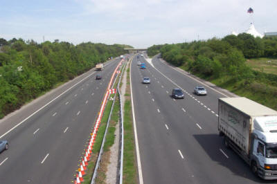
6.4.14. The section of the M4 motorway within the County Borough is part of
the Trans-European Network (TEN) transport route running between the Severn
Bridge and West Wales; which itself forms a part of the strategic link between
Ireland, London, and continental Europe. Particular significance is attached to
the TENs (along with Structural Funds and environmental policy) in the agreed
European Spatial Development Perspective or ESDP (1999), “as….. they
have the most direct effect upon development activities in the European
regions.” Concern has been raised regarding the damage to the economy as a whole
if congestion was allowed to have an adverse effect on the efficiency of the TEN
corridor. Such congestion is more significant at the junctions along the M4
motorway.
6.4.15. The Council will therefore assess critically all development
proposals within the M4 (TEN) corridor to ensure that they will not have an
adverse effect on the efficiency of the M4 motorway, in particular at junctions
35, 36 and 37 in the County Borough. It is with respect to such concerns that
junctions 35 and 36 have already been identified for development-related
improvements in the UDP (Policies T14(5) and T14(13) refer).
6.4.16. New development, and/or the expansion/extension of existing
developments which entails proposed access onto, or in close proximity to, the
motorway junctions in the County Borough will therefore not be permitted, unless
suitable mitigation measures can be secured to satisfactorily address any
adverse effects of proposed developments; and/or it can be clearly demonstrated
to the Council that the traffic impact of those proposals can be satisfactorily
accommodated by the transportation network.

6.5. Parking
6.5.1. DEVELOPMENT OF PRIVATE NON-RESIDENTIAL CAR
PARKING SPACES
POLICY T7
DEVELOPMENT THAT SEEKS TO REDEVELOP OR REUSE PRIVATE NON-RESIDENTIAL CAR PARKING
SPACES, PARTICULARLY IN AREAS WELL SERVED BY PUBLIC TRANSPORT, WILL BE FAVOURED.
6.5.2. The availability of car parking is a major influence on modal choice
and can, in fact, be a more significant factor than the comparative level of
public transport provision. Therefore, if the Council’s strategy to encourage a
shift towards more environmentally sustainable forms of transport is to be
successful, it is important that the whole parking stock, including private
nonresidential parking, should be very carefully managed. Wherever the
opportunity arises, the management of private non-residential parking areas will
consequently be brought within the scope of the Council’s car parking strategy.
Therefore, the Council will favour proposals which include the redevelopment or
re-use of existing areas of private non-residential car parking, with a view to
bringing the provision within current standards of car parking.
6.5.3. NON-OPERATIONAL CAR PARKING WITHIN ESTABLISHED
COMMERCIAL AREAS
POLICY T8
NON-OPERATIONAL CAR PARKING PROVISION WILL NOT BE PERMITTED WITHIN THE CURTILAGE
OF NEW DEVELOPMENT IN THE ESTABLISHED COMMERCIAL CENTRES.
6.5.4. The Council is similarly seeking to encourage the use of alternative
modes of travel into the established commercial centres of the County Borough.
Future parking provision will therefore be based on the needs of the whole area
rather than on dedicated provision for individual developments. The provision of
off-street parking areas which will be shared between complementary land uses
will also be promoted.
6.5.5. The Council will require developers to assess the access requirements
of their proposals, and demonstrate the need for both public transport
facilities and non-operational car parking to service their developments in
their access strategies. Non-operational parking is that which serves the
parking needs of those whose use of a vehicle is not essential for the operation
of a land-use development. On the basis of those assessments, developers will be
asked to provide suitable alternative transportation measures to cater for the
impact of the maximum off-street car parking standards. These measures will
mitigate the impact of those developments by promoting public transport,
walking, cycling, protecting residential areas from on-street parking issues,
and, where appropriate, for enhancing parking facilities in established
commercial centres.
6.5.6. NON-OPERATIONAL CAR PARKING OUTSIDE ESTABLISHED
COMMERCIAL CENTRES
POLICY T9
NON-OPERATIONAL CAR PARKING PROVISION WILL BE STRICTLY LIMITED WITH RESPECT TO
NEW DEVELOPMENT LOCATED OUTSIDE THE ESTABLISHED COMMERCIAL CENTRES.
6.5.7. The Council will be publishing detailed requirements on car parking
standards for new developments as Supplementary Planning Guidance to the UDP in
due course. These guidelines will be used by the Council to establish the
non-operational car parking space requirements of all new developments. The
provision of car parking within a development has been shown to be very
influential in shaping people’s travel choices. The National Assembly for Wales
advises local authorities in its guidance documents to consider reducing the
levels of car parking required in areas where alternative means of transport are
available.
6.5.8. The Council will in turn require developers of sites outside the
established commercial centres to demonstrate in their access strategies that
their proposals will maximise the modal split in favour of alternatives to the
private car. These will include details not only of any new infrastructure
proposed as part of those developments, but also of any ‘pump priming’ necessary
in order to realise a site’s potential to be served by public transport
services. Having thereby identified the extent to which travel demand arising
from their developments may be satisfied by alternative sustainable travel
modes, developers will then be asked to provide residual assessments of any
needs which may remain to be catered for by the private car. The Council will
assess developers’ access strategies and determine the appropriate and albeit
limited levels of non-operational car parking which will be permitted for those
developments.
6.5.9. Policy T9 will be also be applied by the Council to reinforce the
attractiveness and competitiveness of the established commercial centres of the
County Borough by ensuring that non-operational car parking provision for
developments outside those centres does not prejudice provision for the
established commercial centres.
6.6. Freight
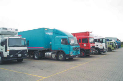
6.6.1. PROPOSED LORRY PARKING
POLICY T10
THE DEVELOPMENT OF ADDITIONAL SITES FOR THE PROVISION OF STRATEGIC LORRY PARKS
AT APPROPRIATE LOCATIONS IN THE COUNTY BOROUGH WILL BE PERMITTED PROVIDED THAT:-
1. THEY CAN BE SHOWN TO BE IN ACCORD WITH SUSTAINABLE TRANSPORT AIMS;
2. THEY DO NOT GIVE RISE TO ENVIRONMENTAL CONCERNS; AND
3. THEY DO NOT DIMINISH EXISTING AMENITIES.
6.6.2. The Sarn Park motorway services site at M4 Junction 36 not only
provides existing lorry parking in the County Borough, but also provides
refreshments and overnight accommodation for travellers. To prevent lay-bys, car
parks, and other inappropriate locations being used for the indiscriminate
parking of lorries and trailers, the Council will only favour proposals for the
development of additional lorry parks at appropriate sites within the County
Borough. In that respect, the proposed use of sites shall be in accordance with
all of the sustainable transport aims and policies contained in the Plan, and
must neither give rise to environmental concern, nor diminish existing
amenities.
6.6.7. MITIGATION OF FREIGHT MOVEMENT ON THE ENVIRONMENT
POLICY T11
DEVELOPMENT OR ITS EXTENSION AT LOCATIONS WHICH WILL GENERATE AND/OR ATTRACT
ROAD FREIGHT MOVEMENTS WHICH:-
1. CAN BE EFFECTIVELY ACCESSED; AND
2. HAVE MINIMAL IMPACT ON THE ENVIRONMENT; OR
3. WHICH USE THE RAIL NETWORK FOR THE MOVEMENT OF FREIGHT;
WILL BE FAVOURED. IN THIS RESPECT A PROPOSED RAIL FREIGHT TERMINAL WILL BE
DEVELOPED AT BROCASTLE, BRIDGEND.
6.6.8 Efficient and reliable movement of freight is vitally important to the
economy of the County Borough. As such, development that generates lorry traffic
will be required to locate in areas that can be effectively accessed, and the
impact of road freight traffic on the environment is minimised. This is
particularly significant to road freight movements in the valley corridors
detailed in Policy T13. Freight related development that uses the rail network
to minimise impact on the environment will also be favoured. In the case of the
road-based option, many acceptable opportunities exist within the County Borough
and these are referred to later in
Policy T13 where transport corridors are
considered.
6.6.9 In recognition of the need for local industry and commerce to move
certain freight by road in the County Borough, the Council will seek to enter
into voluntary agreements with the business community and the hauliers
concerned, with a view to restricting the use of unsuitable roads by HGVs
wherever and whenever satisfactory alternative routes or options exist. Such
agreements will be supplemented, where necessary, by appropriate road traffic
regulation orders. With regard to the railways, the Council fully supports the
use or expansion of the rail network in the County Borough for the movement of
freight. Indeed, by pursuing the rail freight option for certain locations for
development which entail the movement of freight, some development proposals
will become favourable in principle which would otherwise be considered
unacceptable, and therefore not permitted.
6.7. Public Rights of Way
6.7.1. DEVELOPMENT AFFECTING PUBLIC RIGHTS OF WAY
POLICY T12
DEVELOPMENT PROPOSALS THAT DO NOT CATER FOR ‘PUBLIC RIGHTS OF WAY’ IN NEW
DEVELOPMENTS, AND/OR WHICH DO NOT PROTECT THE EXISTING NETWORK FOR PUBLIC USE,
WILL NOT BE PERMITTED.
6.7.2. ‘Public Rights of Way’ as referred to in
Policy T12 relate to
non-carriageway highways and include footpaths, bridleways, byways open to all
traffic, and cycle tracks: all being statutory highways.
6.7.3. Footpaths and bridleways were originally a vital means of getting to
work, visiting relatives and friends, and accessing many other activities.
Today, many of these journeys are undertaken using a motor car or alternative
forms of transport, and these facilities are more usually seen as a recreational
asset. Within the context of sustainable transportation it is important that
walking, as a means of travel, is encouraged; therefore facilities should be
protected and developed to meet the needs of the pedestrian. The Council will
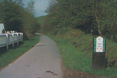
therefore protect “public rights of way” to maximise the modal split in favour
of walking.
6.7.4. Similarly, bridleways will also be protected for in the context of
transportation, they represent rights of way for the public to walk or ride on
horseback, and therefore also contribute to facilities which encourage walking.
6.7.5. Development must therefore cater for existing rights of way by either
protecting the right of way, or providing an equally effective alternative
route. In either case, the right of way affected by the development must be
dealt with in such a way as to provide a safe and pleasant environment for all
pedestrians, and which will encourage its future use.
6.7.6. Cycling, like walking, does not create pollution and is a sustainable
mode of transport which should be encouraged. Development must therefore also
cater for cycle tracks either by protecting the existing tracks, or by providing
an equally effective alternative route, which is safe and pleasant to use.
6.8. Transport Corridors
6.8.1. DEVELOPMENT IN TRANSPORT CORRIDORS
POLICY T13
THE FOLLOWING TRANSPORT CORRIDORS ARE IDENTIFIED AS THE MAIN ROUTES IN THE
COUNTY BOROUGH FOR THE MOVEMENT OF PEOPLE AND GOODS. DEVELOPMENT WHICH WOULD:-
(A) ADVERSELY AFFECT SAFE AND EFFICIENT MOVEMENT IN THESE CORRIDORS, AND/OR
(B) WOULD CREATE OR EXACERBATE HARM TO THE ENVIRONMENT ALONG THEM, AND
(C) WOULD NOT BE CAPABLE OF MITIGATION;
WILL NOT BE PERMITTED. THE CORRIDORS ARE:
T13(1) M4;
T13(2) LLYNFI;
T13(3) GARW;
T13(4) OGMORE;
T13(5) PYLE-ABERKENFIG;
T13(6) A473-A48;
T13(7) WATERTON ROUNDABOUT-LALESTON;
T13(8) A4106-A4229;
6.8.2. As there is a need to consider all forms of movement, transportation
links and infrastructure along transport routes in the context of the
topographic characteristics of the County Borough through which they pass
(especially its valleys and existing layout of the highway network), it is a
prerequisite that movements within the Authority should be considered on a
strategic corridor basis. This method of considering the Authority’s existing
transportation network, and the effects on it of development, therefore, more
accurately models the actual situation.
6.8.3. The corridor approach also allows the management and allocation of the
existing road network to be carried out more effectively; for example, the
location of development proposals can be assessed, and their demand on
transportation and environmental standards, as affected by transportation issues
along the length of the corridor, considered. This is of particular importance
when development proposals are assessed in the valley corridors, where the
quality of the transportation network varies greatly along its respective
corridor, and alternative transport routes are generally unavailable.
6.8.4. The standards to be considered will not only be limited to traffic
capacity, which is determined by the width and alignment of the carriageway and
junctions. Factors such as the degree of priority to be accorded to pedestrians,
cyclists and public transport, frontage activity, conservation area designation,
residential areas, on-street parking, location of schools and hospitals, noise,
air quality, and risk of accident will also be considered. These factors will
assist in assessing the maximum capacity and the nature of vehicles compatible
with acceptable environmental standards associated with transportation issues.
6.8.5. The corridors will be managed to promote public transport, cycling and
pedestrian movement, especially as this relates to journeys to work. It has also
already been recognised that the efficient and reliable movement of freight is
vitally important to the economy of the County Borough. As such, development
which generates lorry movement will be required to locate in areas which can be
effectively accessed and the impact of the road freight movement on the
environment is minimised. This is particularly significant to the valley's
corridors as previously referred to.
6.8.6. Details of the corridors identified in
Policy T13 are as follows:-
1. M4 Corridor
6.8.7. This corridor includes the primary strategic highway and railway
network of South Wales, i.e. the M4 motorway, and the main Paddington to
Fishguard railway line including the principal station at Bridgend. Although it
is the responsibility of the Welsh Assembly Government, the M4 motorway
also serves the strategic needs of the County Borough and acts as an effective
link from east and west. In view of its status as a Trans European Route Network
(TERN) and its strategic significance to the whole of South Wales, it is
imperative that the Council and its neighbouring Authorities, collaborate with
the Welsh Assembly Government in the effective management of the M4 motorway.
6.8.8. The Council will therefore assess all development proposals within the
M4 Corridor to ensure that they do not have an adverse effect on the efficiency
of the motorway, and particularly its junctions 35, 36 and 37. It is with
reference to this issue that Junction 36 is identified for development-related
improvements in Policy T14(5).
6.8.9. It is this corridor that provides the greatest opportunities to
support development which generates lorry movements, as it is effectively
accessed and the impact of road freight movement on the environment can be
minimised, provided that appropriate locations and highway improvements are
identified.
6.8.10. Any developments, which have a direct effect on the M4 motorway
junctions within the County Borough will have to be considered very carefully.
Development which will have direct access, or accesses, in close proximity to
those junctions is likely to have an adverse effect on their efficiency, which
can therefore have a negative impact on the whole of the County Borough and
possible implications for South Wales. Therefore such development will be
resisted by the Council unless it can be demonstrated that the traffic impact of
the proposals can be accommodated by the motorway and its junctions either in
the short or the long term.
6.8.11. The South Wales Mainline is the responsibility of Network Rail, but
is another strategic link within the County Borough which must be protected.
Development, and future management measures which will encourage its use by
commuters, and for the movement of freight will therefore be favoured by the
Council (see Policy T11).
2. Llynfi Corridor
6.8.12. The Llynfi Corridor is based on the principal route A4063 which runs
from the northern border of the County Borough through the upper Llynfi Valley
settlements, including Maesteg, to join the Pyle-Aberkenfig Corridor at
Aberkenfig. From here the corridor continues to follow the A4063 both southward
to Bridgend town centre and eastward along the Sarn Link to arrive at Junction
36 of the M4 motorway. The corridor also includes the Maesteg to Bridgend
railway line.
6.8.13. The nature of the A4063 varies as it travels down the Llynfi
Corridor. From the north, passing through Caerau, Nantyffyllon, Maesteg Town
Centre and Pont Rhyd-y-Cyff, its standard and specification is limited, and
transportation-related environmental issues arise regarding development. Further
south, the specification and alignment of the A4063 improves, especially from the Paper Mills to Coytrahen. However, through Coytrahen
village, and until the railway bridge where the A4063 meets the A4065, the
road’s alignment and standard, the proximity of residential properties, and
frontage accesses, all limit the capacity of the highway, and again raise
transportation-related environmental issues. From the railway bridge along the
Sarn Link to Junction 36 the highway has a good specification with limited
transportation-related environmental issues. From the aforesaid railway bridge
to Bridgend town centre the highway is also of a generally good specification,
however, some issues arise in relation to the hospital, general visibility, and
other junctions.
6.8.14. There are opportunities for management and improvement of this
corridor in terms of the transportation-related environmental issues. However,
capacity issues will remain related to highway movement, which cannot be
avoided, and will therefore act as a constraint. One major site on this corridor
which is not affected by such a constraint, but which does require highway
works, however, is Land West of Maesteg Road (this includes the former
ironworks), Tondu (Policy REG3(3) refers), access to which will be dealt with
under Policy T14(8).
6.8.15. Development which will be served by the highway will be considered,
not only upon the basis of how it will affect the local area, but also for its
transportation impact on the corridor northwards, but more especially
southwards, as vehicles travel towards the M4 Corridor.
6.8.16. The Maesteg to Bridgend railway line is a major asset to the
Corridor, which can be used to move both commuters and freight. Therefore the
opportunity for development within the corridor to be served by the railway is
considerable, and this will be encouraged by the Council to maximise its
potential benefits.
3. Garw Corridor
6.8.17. The Garw Corridor is based primarily on the principal route A4064
which runs southwards from the settlement of Blaengarw passing, in turn, through
Pontycymmer and Llangeinor. Further south, the route forks, and as the A4065,
passes through Ynysawdre, joins the Llynfi Corridor at the Aberkenfig railway
bridge and joins the Ogmore Corridor at its junction with the A4061.
6.8.18. Although the nature of the A4064 varies as it runs along the
corridor, it is generally of a limited standard and specification which raises
transportation-related environmental issues. There are opportunities for
management and improvement of the corridor but there is limited potential for
increasing its capacities which will therefore act as a constraint. Two
employment areas on this corridor which have fewer capacity constraints are, the
Abergarw and Brynmenyn Industrial Estates. However, these two sites do generate
transportation-related environmental issues on the Ogmore Corridor.
6.8.19. Development which will be served by the highway will be considered,
not only upon the basis of how it will affect the local area, but also for its
transportation impact on the corridor northwards, but more especially
southwards, as vehicles travel towards the M4 Corridor.
4. Ogmore Corridor
6.8.20. The Ogmore Corridor is based primarily on the principal route A4061
which commences from the northern border of the County Borough with Rhondda
Cynon Taff County Borough then runs southwards through the settlements of
Nantymoel, Pricetown, Ogmore Vale, Lewistown, Pantyrawel, Blackmill, and
Bryncethin. It then crosses the M4 motorway at junction 36 and along the
Bridgend Northern Distributor Road and terminates at Bridgend town centre. The
corridor also includes the principal route A4093 which runs eastward from
Blackmill to the border with Rhondda Cynon Taff County Borough.
6.8.21. The nature of the A4061 varies as it runs along the Ogmore Corridor
passing through urban areas with frontage accesses, residential areas, and rural
areas. The standard and specification of the route is equally varying, changing
from narrow lane to dual carriageway.
6.8.22. There are opportunities for management and improvement of the
corridor on both the A4061 and A4093 in terms of transportation-related
environmental issues. However, at various locations along the route the highway
capacity and the transportation-related environmental issues which arise will
act as a constraint on development.
6.8.23. Development will be considered not only on the basis of how it
affects the local area but also for its transportation impact on the corridor
northwards, but more especially southwards, as vehicles travel towards the M4
Corridor.
5. Pyle-Aberkenfig Corridor
6.8.24. The Pyle-Aberkenfig Corridor is based on the route B4281 from where
it meets the A48 at Pyle Cross running eastward through Pyle, Kenfig Hill, and
Cefn Cribbwr until terminating at its junction with the A4063.
6.8.25. The standard and specification of this route is low which raises many
existing transportation-related environmental issues including the risk of
accidents especially where it passes through residential and retail areas.
6.8.26. There are opportunities for management and improvement of the
corridor in terms of those issues, but no opportunity to increase the route’s
capacity. Therefore, there are considerable constraints on the ability of this
corridor to support development. Efforts will also have to be made to ensure
that the proposed new mining works at Margam do not have a detrimental effect on
this corridor.
6. A48-A473 Corridor
6.8.27. This corridor starts at the point where the A473 route enters the
County Borough, from neighbouring Rhondda Cynon Taff County Borough, and runs
along the Pencoed Bypass to junction 35 on the M4 motorway. The route then
continues as the A473 until it joins with the A48 at Waterton Roundabout. From
Waterton Roundabout the route continues as the A48 until it meets the boundary
of the County Borough to the west of Pyle and then enters Neath Port Talbot
County Borough.
6.8.28. Use of this corridor raises issues of constraint at the junctions of
its routes, and some issues of transportation-related environmental concern,
more particularly at its western and eastern extremities. Notwithstanding this,
the corridor provides an opportunity to support development which generates
lorry movements as it is effectively accessed, and the impact of the road
freight movement on the environment can be minimised, if appropriate locations
for highway improvements are identified.
7. Waterton Roundabout-Laleston Corridor
6.8.29. This corridor is based on the principal route A473 from where it
meets the A48 at Waterton Roundabout running northwestwards to the Bridgend
Inner Bypass, then westward and terminating at its junction with the A48 west of
Laleston.
6.8.30. The route varies in standard from dual carriageway to single
carriageway and the areas it serves are substantially urban in nature apart from
the most westerly section of the route. This corridor provides accesses to
Bridgend town centre from the south, Bridgend Technical College, the South Wales
Police HQ and substantial residential areas, with some sections of the route
having residential frontages.
6.8.31. The corridor currently suffers from congestion, and there are other
concerns which raise transportation-related environmental issues. There are
opportunities for the management and improvement of the corridor in terms of
those issues, and a major highway improvement scheme is contained in
Policy
T14(4) to construct the Coychurch Road - Cowbridge Road Link in Bridgend town.
6.8.32. The corridor provides an important access into Bridgend town centre,
which must be protected. In addition, at various locations along the route, the
highway capacity and transportation-related environmental issues will act as
constraints. Any development will be considered for its transportation impact in
the light of these constraints.
8. A4106-A4229 Corridor
6.8.33. This corridor is based on the principal route A4106 from where it
meets the A48 at Redhill Roundabout travelling south westward to its junction
with the principal route A4229 at Porthcawl. The corridor then follows the A4229
northwards until its junction with the B4283 at which the route forks and, as
the A4229, it continues through junction 37 on the M4 motorway and terminates at
its junction with the A48 at Pyle Roundabout. As the B4283, it continues
northwards through North Cornelly until it meets the boundary of the County
Borough where it enters Neath Port Talbot County Borough.
6.8.34. The route varies in its nature with sections of dual carriageway and
country lane but for the majority of the length, the route is a single lane
carriageway. This corridor also provides access to Porthcawl town centre and its
tourist facilities.
6.8.35. With regard to its ability to serve Porthcawl, the corridor has
sufficient capacity to provide for its residential population, and on average
its requirements as a tourist resort. It does not have the facility to cater for
traffic flows at peak days within the year, such as sunny bank holidays, and it
would be environmentally unacceptable to provide for that level of network
capacity.
6.8.36. To allow for additional development and the re-development of
Porthcawl town centre and resort to progress, new park and ride facilities
(Policy T18 refers) linked to a dedicated bus route are proposed in the UDP, and
enhanced public transport facilities will be required in this corridor.
6.8.37. There are also opportunities for management and improvement of the
corridor, on both the A4106 and A4229, in terms of transportation-related
environmental issues but no acceptable opportunities to increase further the
route’s capacity.
6.8.38. Development in this corridor, including that in Porthcawl town centre
and resort, will be considered for its transportation impact not only on the
basis of how it affects the local area but also for its effect on the routes to
Junction 37 of the M4 motorway and to the A48.
6.8.39. The route B4283, which is included in this corridor, is limited by a
low headroom bridge where it passes beneath the M4 motorway. This route serves
the residential community of North Cornelly and has a substantial number of
frontage properties, on street parking, shops, schools and pedestrian movement.
The existing highway network is not appropriate to accommodate the additional
traffic movement generated by development and it cannot be significantly
improved.
6.8.40. The route B4283, for the reasons stated in para. 6.8.39. above, is
not suitable to carry significant levels of heavy goods vehicles. However, due
to a low headroom bridge, within Neath Port Talbot County Borough, such vehicles
serving the Kenfig Industrial Estate within that Authority, have to use this
highway. The Council will work in partnership with Neath Port Talbot County
Borough Council to provide a more appropriate access to the Kenfig Industrial
Estate, thereby removing the associated heavy goods vehicle movements from this
corridor. There are opportunities for management and improvement of the B4283 in
terms of transportation-related environmental issues but no opportunity to
increase its capacity. Therefore, there are considerable constraints on the
ability of this corridor to support development. Efforts must also be made to
ensure that no additional pressure is placed by heavy goods vehicle movements on
the B4283.
6.9. The Highway Network
6.9.1. The major highway network, which performs a key role within all of the
transport corridors of the County Borough has already been described in detail
in the preceding section 6.8. of this Plan. Also within that section, the
Council highlighted those areas and locations where transportation, and
transportation-related environmental issues either have already, or are
considered likely to arise in future, within those corridors. The proposals
contained in Policy T14 (below) address such concerns, however, bearing in mind
the multi-modal approach which the Council has adopted in both its UDP and LTP
to transport corridor improvements, future feasibility studies may need to be
undertaken to identify further satisfactory measures to be implemented as part
of the LTP process, and to cater for specific local land-use development
proposals. Forthcoming proposals which emerge from the shorter-term reviews of
the LTP will also, therefore, need to be revisited when the UDP is reviewed.
6.9.2. MAJOR IMPROVEMENTS TO THE HIGHWAY NETWORK
POLICY T14
MAJOR IMPROVEMENTS TO THE HIGHWAY NETWORK WILL BE UNDERTAKEN AT THE FOLLOWING
LOCATIONS:-
T14(1) (A & B) BRACKLA INDUSTRIAL ESTATE ACCESS ROAD, BRIDGEND;
(Link to Map 28 West)
T14(2) B4281/HEOL SIMONSTON IMPROVEMENT, BRIDGEND; (Link
to Map 28)
T14(3) PENCOED INNER RELIEF ROAD; (Link to Map
22 East)
T14(4) COYCHURCH ROAD - COWBRIDGE ROAD LINK, BRIDGEND;
(Link to Map 35 East)
T14(5) M4 JUNCTION 36; (Link to Map 21)
T14(6) ACCESS TO THE FORMER MAESTEG WASHERY SITE; (Link
to Map 33 East)
T14(7) WERN TARW/ROCKWOOL ACCESS; (Link to Map
22 East)
T14(8) ACCESS TO LAND WEST OF MAESTEG ROAD, TONDU; (Link
to Map 21 West)
T14(9) A48/A473 BROCASTLE LINK, BRIDGEND; (Link
to Map 31)
T14(10) ACCESS TO MARLAS FARM SITE, PYLE; (Link to Map 19)
T14(11) ACCESS TO MERTHYR MAWR ROAD/BRIDGEND SCIENCE PARK, A48,
BRIDGEND; (Link
to Map 27 Central)
T14(12) A473 ACCESS TO THE ‘SONY TECHNOLOGY PARK’, PENCOED; (Link to Map 23 East)
T14(13) M4 JUNCTION 35; (Link to Map 23 East)
T14(14) COITY BYPASS, BRIDGEND; (Link to Map 22 West)
AND WILL BE SUBJECT TO FORMAL AGREEMENTS WITH THE COUNCIL, AND/OR AS DETAILED
AND APPROVED WITHIN THE APPROPRIATE DEVELOPMENT BRIEFS.
6.9.3. A number of allocations for development have been made in the UDP
which are likely to have a significant impact on the existing transportation
network. Policy T14 of the Plan identifies fourteen highway improvement schemes
that should overcome the problems for the network which the new development
proposals are predicted to cause. With the exception of
Policy T14(4), which is
being promoted by the Council itself (as part of the Bridgend Town Centre
Regeneration Strategy), all of the remaining schemes relate to significant
land-use proposals.
6.9.4. The Council will therefore expect the characteristics and details of
all the above transportation schemes to be addressed in appropriate Development
Briefs which must be prepared, submitted to, and approved by the Authority,
prior to the relevant planning applications for site development(s) being
determined. Those Development Briefs will specify the overall transportation
requirements, implementation, environmental and impact criteria to be addressed
for each site; details of any studies to be carried out; or reports which must
be prepared to establish the acceptable levels of traffic generation from the
site(s), i.e. through requisite Transport Assessments. Developers will be
responsible for carrying out any studies as detailed, and final development
proposals, which, when submitted as planning applications, must conform
with the requirements specified in the relevant Development Briefs. It should be
noted that all of the associated developments to
Policy T14 will also be subject
to all of the Council’s Transportation Policies.
6.9.5. When approved, the resultant Development Briefs shall form the basis
on which the Authority will attach appropriate planning conditions to any
forthcoming planning consents for the relevant site(s)’s development. The
approved Briefs will also specify any ‘material’ matters (including the likely
impact of the proposal(s) on the transportation network, and indicate any
necessary mitigation measures proposed) which the Council requires to be
addressed and agreed by developers/owners of sites through formal planning
obligations/agreements with itself. Otherwise, planning consents for those
developments will not be forthcoming. In this respect, it is emphasised that the
Council will require appropriate contributions from developers/owners of sites
which have a ‘connection’ not only with those highway improvement schemes listed
under Policy T14, but also with any other policies, objectives, and aims of the UDP and LTP which it considers to be ‘material’ to the satisfactory development
of those site(s), always providing that the requirements of the ‘legal test’ for
such a ‘connection(s)’ is (are) met.
6.9.6. Details of the fourteen schemes identified in
Policy T14 are as
follows:-
1. (A & B) Brackla Industrial Estate Access Road,
Bridgend
6.9.7. The expansion and re-development of Brackla Industrial Estate (Policy
E2(1)), and the allocation for residential development (Policy H1(81)), will
increase volumes of traffic along Heol Simonston down to its junction with the
A473 at Coychurch Roundabout. Heol Simonston will therefore be upgraded in
accordance with Policy T14(2). In addition, developers of Policies
E2(1) and
H1(81) will be required to contribute to highway improvements to provide a high
quality link from Heol Simonston to the Princess Way – BNDR roundabout link, to
accommodate the additional traffic generated, and to remove the interaction of
industrial and residential traffic using Wyndham Close.
6.9.8. Policy T14(1) is therefore split into two sections (A) and (B). The
provision of section (A) of the highway scheme will be a requirement for the
development of, and will form part of the northern boundary to, residential
allocation H1(81) ‘Wyndham Close, Brackla, Bridgend’; whereas section (B) will
progress the new highway link to Princess Way – BNDR roundabout, to be provided
by the developers/redevelopers of the new and remaining areas of land within
Policy
E2(1) ‘Brackla Industrial Estate, Bridgend’.
2. B4281/Heol Simonston Improvement, Bridgend
6.9.9. The development and redevelopment of the new and remaining areas of
Brackla Industrial Estate, will increase volumes of traffic along Heol Simonston/B4281,
from its junction with the proposed Brackla Industrial Estate Access Road to its
junction with the A473 at Coychurch Roundabout. The route is generally
sub-standard in terms of its width, alignment, visibility, provision of
pedestrian facilities and the lay out of junctions, and is not suitable to
accommodate the traffic generated by the proposed developments; therefore, it
must be improved to enable those developments to proceed.
6.9.10. Future developers and redevelopers of the new and remaining areas of
the Brackla Industrial Estate will therefore be required to enter into
appropriate planning obligations/agreements with the Council, and/or it will
impose the appropriate planning conditions on relevant planning consents, to
ensure that the necessary highway works and improvements will be provided. The
works will therefore be entirely funded by those developments, and, where
appropriate, will include realignment of the carriageways, junction improvements
and capacity enhancements, and provision of full pedestrian facilities to
eliminate conflict with the additional traffic generated.
3. Pencoed Inner Relief Road
6.9.11. As the existing highway network is constrained by the main line
railway passing through Pencoed, no further development to the west of the
railway will be permitted until a scheme has been implemented which will allow
the network to accommodate the additional traffic movements associated with
development. The required highway scheme will consist of a new bridge over the
railway, and an appropriate link to approved standards, commencing from Hendre
Road then passing over the new railway bridge linking into Penybont Road.
Developers of all sites to the west of the railway will therefore be required to
enter into agreements with the Council to contribute appropriate sums to ensure
that the required highway works and improvements will be provided. These works
will therefore be entirely funded by those developments.
6.9.12. It should be noted that planning permission has previously been
granted for 200 houses west of the railway line in accordance with the
provisions contained in the adopted Ogwr Borough Local Plan. That consent was
subject to the construction of an interim relief road link and signalled
junctions. However, those highway works are only sufficient to accommodate
movements related to that development and cannot therefore be used as a means of
progressing any further development west of the railway until the new scheme
referred to in para. 6.9.11. (above) has been implemented.
4. Coychurch Road – Cowbridge Road Link, Bridgend
6.9.13. The Council considers this scheme to be an important element in the
regeneration of Bridgend town centre, as its implementation will complete an
integrated inner road distributor 'box' around the town centre. The scheme will
also allow the existing junction of Coychurch Road and Cowbridge Road (which is
severely restricted in both layout and visibility and has a poor highway safety
record), to be either closed-off completely, and/or provide only limited local
accesses. If the existing junction was to be improved, this would offer only
limited local benefits and would require additional demolition of existing
properties, and is not therefore favoured by the Council.
6.9.14. The identified line of the proposed link road conforms to current
highway design standards including predicted traffic flows, and therefore
reflects current planning guidance and Council policies which aim to protect
residential properties from unnecessary demolition regarding development.
5. M4 Junction 36
6.9.15. The M4 motorway junction 36, at Sarn, is the most important strategic
junction in the County Borough and is under considerable pressure from traffic
movements related to the retail development in the area, combined with the local
and strategic traffic movements on the surrounding highway network. The
junction's existing capacity constraints are not suited to accommodate
additional traffic movements generated by any further development having a
direct effect upon it. The development of the Parc Derwen development site
Policy H1(25) refers), or any other development or expansion of existing
development having a direct effect on this junction, will not therefore be
permitted until it has been improved. The aim is to increase the junction's
capacity to a level where it can accommodate additional traffic movements
generated by development without detrimental effects being imposed on either
local or strategic traffic movements.
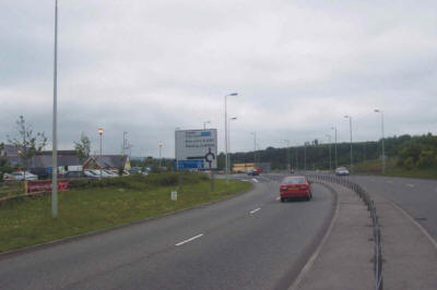
6.9.16. Developers of the Parc Derwen site, or any other development or
expansion of existing development having a direct effect on the junction will
therefore be required to enter into agreements with the Council to ensure that
appropriate highway works and improvements will be provided. The works will be
entirely funded by those developments, whose piecemeal development or expansion
will not be permitted.
6. Access to the Former Maesteg Washery Site
6.9.17. The former Maesteg Washery site has been identified for mixed-use
development including a new secondary school, and as such, the site must be
appropriately accessed. These arrangements shall provide access to the whole
site, and will include effective provision for car, public transport, cycling
and pedestrian movements. Special consideration will be given to the safe access
provisions required for the proposed school. Where the proposed site
infrastructure meets the existing highway network, junctions will be constructed
to accommodate the whole development, i.e. its generated traffic movements as
well as those of the existing local network. The overall traffic generation and
nature of traffic from the new development, will be controlled to ensure that it
does not adversely affect traffic movements on the existing network.
6.9.18. All details related to access issues for the site will be defined in,
and controlled by, the Development Brief required under
Policy REG 3(1), and as
referred to in paras. 6.9.4. and 6.9.5 earlier.
7. Wern Tarw/Rockwool Access
6.9.19. The existing Rockwool factory and land immediately to the west and
north west has been identified for employment uses at Wern Tarw. The highway
access to and from this site is by means of the unclassified road from the
factory to the B4280, the B4280/Penprysg Industrial Access Road, then the A473/Pencoed
Bypass to Junction 35 of the M4. Developers of this site, or of significant
intensifications/expansions to the Rockwool development, will therefore be
required to carry out any improvements to that route which are necessary for it
to cope safely and efficiently with any additional traffic generated by those
developments and/or expansions. These improvements will include, but not be
limited to, improving the unclassified road and the B4280 between the site
entrance(s) and the western end of the Penprysg Industrial Access Road, the
section of the A473 between the eastern roundabout of the Penprysg Industrial
Access Road, and the northern roundabout of the Pencoed Bypass. They will also
include any modifications required to those roundabouts or any other sections of
highways along that route including provisions required for cycling or
pedestrian safety.
6.9.20. Therefore, developers of the Wern Tarw site, or of significant
expansions to the Rockwool development will be required to enter into any
necessary planning obligations/agreements with the Council to ensure that
appropriate highway works and improvements will be provided. These works will be
entirely funded by those developments and/or intensifications/expansions to the
existing Rockwool development.
8. Access to Land West of Maesteg Road, Tondu
6.9.21. The land to the west of Maesteg Road (A4063), Tondu has been
identified in the UDP for proposed mixed development of employment, residential
and heritage uses. The A4063 highway to the south of the nearby railway bridge
is up to the necessary standard to accommodate the traffic movements related to
the proposed development of the site. However, as it proceeds north from the
traffic signals, beneath the railway bridge, then bearing sharply eastwards, the
highway is sub-standard with poor visibility and several existing accesses. In
order that the site can be developed comprehensively, the A4063, Maesteg Road,
north of the existing traffic signals will need to be re-aligned to allow for an
appropriate access to be constructed to serve the development. The comprehensive
development of the site must be in accordance with a Development Brief (as
referred to in paras. 6.9.4. and 6.9.5. earlier), to be agreed with the Council.
This will ensure that an effective highway infrastructure can be implemented
that will serve the whole site.
6.9.22. The developers of the site will therefore be required to enter into
planning obligations/agreements with the Council to ensure that appropriate
highway works and improvements will be provided. The works will be entirely
funded by the development, whose piecemeal development or expansion will not be
permitted.
9. A48/A473 Brocastle Link, Bridgend
6.9.23. Development of the Brocastle, and Waterton Industrial sites for
employment purposes, i.e. between the existing car engine plant and the A48,
will produce increased traffic movements at the roundabout junction of the A48
with the A473 at Waterton as traffic travels north eastward to the M4 motorway
via junction 35. A redesign and signalling of the Waterton Roundabout would only
provide a partial solution to this problem, whereas, the sites can be most
effectively accessed by a new road link which will proceed in a generally north
eastward direction from a new junction on the A48 to the southern-most
roundabout within the Waterton Industrial Estate and then northwards with
associated improvements to the Coychurch roundabout to join the A473 to the
motorway. The nature and extent of highway works will be determined by a
Transport Assessment. Part of the line of the proposed link road will lie within
the Vale of Glamorgan Council area and their consent and co-operation will be
sought to expedite its development.
6.9.24. Developers of the Brocastle, and Waterton Industrial sites (between
the car engine plant and the A48) will therefore be required to enter into
appropriate planning obligations/agreements with this Council, and the Vale of
Glamorgan Council, to ensure that the necessary highway works and improvements
will be provided to serve these developments. These works will be entirely
funded by those developments, whose piecemeal, or the expansion of existing,
development of either site will not be permitted.
10. Access to Marlas Farm Site, Pyle
6.9.25. Access to the proposed Marlas Farm housing site could be achieved
either by way of a southern route onto Heol Fach then through North Cornelly
village; or northwards by way of Marlas Bridge and Marlas Road to Pyle Cross.
The former route presents problems in respect of parked vehicles, service
vehicles and shops, schools, pedestrian safety, junctions, in particular that
with Fairfield, leading to the A48, and a low bridge on the direct link to the
M4 motorway. The existing highway network cannot therefore accommodate the
additional traffic movement which would be generated by the proposed housing
development, without significant improvements being made to it. The latter
option is by way of a narrow lane, over Marlas Bridge, which is substandard in
width and alignment, along Marlas Road, towards Pyle Cross which has also been
identified as having road safety problems.
6.9.26. Development of the Marlas Farm residential site may therefore only
proceed subject to highway improvements being carried out at Marlas Bridge and
on Marlas Road to accommodate the additional traffic which would be generated by
its development. Also the lane from the site which would access Marlas Bridge
must be improved to the appropriate highway standards, and an enhanced
pedestrian access route provided to the nearby Pyle Station.
6.9.27. Developers of the Marlas Farm site will therefore be required to
enter into agreements with the Council to ensure that the appropriate highway
works and improvements will be provided in addition to any other relevant
planning requirements. These works will be entirely funded by the development,
whose piecemeal development will not be permitted.
11. Access to Merthyr Mawr Road/Bridgend Science
Park/Land at Island Farm, A48, Bridgend
6.9.28. Bridgend Science Park/Land at Island Farm is identified as a special
employment site, (Policy
E6(1) refers), which is based on a number of
requirements, one of them being that it is highly accessible from the M4
corridor. To provide this effective access, and thereby conform to the
requirements of the highway network, the proposed extension to the existing
Science Park at Island Farm, will require a new junction to be constructed on
the A48 at a location which will affect, and have to include junction facilities
for, Merthyr Mawr Road (North and South of the A48). Therefore, careful
consideration must be given to this junction to ensure that it, or the
associated development traffic, does not have an adverse effect on the
efficiency of the surrounding highway network.
6.9.29. Developers of the Science Park extension will therefore be required
to enter into planning obligations/agreements with the Council to ensure that
the appropriate highway works and improvements will be provided in addition to
any other relevant planning requirements. These works will be entirely funded by
the development, whose piecemeal development will not be permitted.
12. A473 Access to the ‘Pencoed Technology Park’,
Pencoed
6.9.30. The ‘ Pencoed Technology Park’, Pencoed, is identified as a special
employment site, (Policy E6(4) refers), which requires the land to be highly
accessible from the M4 corridor. The site is a large area of land, some 31.5 Ha,
and although being located substantially within the administrative boundary of
the Rhondda Cynon Taff County Borough Council, its access requirements will be
primarily required from Junction 35 of the M4 Motorway at Pencoed. Therefore,
the associated transportation issues for servicing this site satisfactorily, and
ensuring effective access to the motorway falls to this Council.
6.9.31. The existing Sony development is served from a roundabout on the A473
which also provides links to Felindre Road both east and west. This roundabout
is at present subject to congestion problems at certain times of the day, as is
the access on to the motorway junction south of this roundabout. A further
consideration is the location of an existing cemetery which would be in close
proximity to any infrastructure improvements if it is proposed to access the
Policy E6(4) site from a junction on Felindre Road. Therefore, the proposals to
access this site must adequately cater for improvements to the highway
infrastructure. This will ensure that both the Sony Roundabout and the motorway
junction cater for, and work efficiently with, the additional development
traffic and that the cemetery is adequately protected from the adverse effects
of the traffic generated by the development and any required improvements.
6.9.32. Developers of the Pencoed Technology Park, Pencoed, will therefore be
required to enter into planning obligations/agreements with the Council(s) to
ensure that the appropriate highway works and improvements will be provided, in
addition to any other relevant planning requirements. These works will be
entirely funded by the development, whose piecemeal development will not be
permitted.
13. M4 Junction 35
6.9.33. The M4 motorway junction 35 at Pencoed is an important strategic
junction in the County Borough. The junction's existing capacity, although
adequate for current demands, will not accommodate all the additional traffic
movements generated by further development without improvement. Therefore land
will be protected for the future improvement of the motorway roundabout. It is
anticipated that the junction's capacity can be improved on a phased basis to
accommodate new developments as they come on stream.
6.9.34. Developers whose new developments, or expansion of existing
developments, which have an effect on junction 35 will be required to improve
the junction's capacity to a level where it can accommodate additional traffic
movements (generated by the development(s)) without detrimental effects being
imposed on either local or strategic traffic movements.
6.9.35. Developers of sites or expansion of existing sites having an effect
on Junction 35 of the M4 Motorway will therefore be required to enter into
planning obligations/agreements with the Council to ensure that appropriate
highway works and improvements will be provided. The works will be entirely
funded by those developments, whose piecemeal development or expansion will not
be permitted.
14. Coity Bypass, Bridgend
6.9.36. The development of the Parc Derwen site (Policy
H1(25) refers) would
significantly increase the volume of traffic passing through the village of Coity unless associated highway works are carried out. The B4281 road through
the village of Coity is generally sub-standard in terms of its width, alignment,
visibility, provision of pedestrian facilities and lay-out of junctions. The
village is also a designated Conservation Area.
6.9.37. There is no opportunity for improvement of the highway through Coity
village, and in any event, this would not be environmentally acceptable.
Therefore a bypass to the village must be constructed if the development of the
Parc Derwen site is to proceed. Such a bypass will also be expected to provide
access to those areas of land designated for employment purposes (under
Policy
E2(1) of the Plan), south of the proposed bypass, which are presently
‘land-locked’ from earlier development. The developers of the Parc Derwen site
will therefore be required to enter into a planning obligation/agreement with
the Council to ensure that appropriate highway works and improvements will be
provided, as a requirement of the Development Brief to be prepared, submitted,
and approved by the Council for the development of that site. Those highway
works and improvements will include a bypass to the village, facilities for
access to those presently ‘landlocked’ areas of
Policy
E2(1), and appropriate
measures to ensure that extraneous traffic will not travel through the village.
Other highway works will include sufficient, effective, and appropriate access
points to the development sites to ensure adequate and suitable movement both
within the sites and on the existing highway network. The works will be entirely
funded by the developers of the Parc Derwen development, whose piecemeal
development will not be permitted.
6.10. Public Transport Infrastructure Provision
6.10.1. EXTENSION TO BRIDGEND BUS STATION
POLICY T15 (Link to Map 34 Central)
LAND WILL BE SAFEGUARDED TO ENABLE THE RE-DEVELOPMENT OF THE BRIDGEND TOWN
CENTRE BUS STATION.
6.10.2. The existing bus station in Bridgend town centre is being used to its
full capacity, therefore there is a need to re-develop that capacity to meet
existing and future demand from local and national operators.
6.10.3. PROPOSED BRIDGEND TRANSPORT INTERCHANGE
POLICY T16
LAND WILL BE SAFEGUARDED TO ENABLE THE CONSTRUCTION OF A TRANSPORT INTERCHANGE
AND ASSOCIATED ACCESS ROADS IN BRIDGEND TOWN CENTRE.
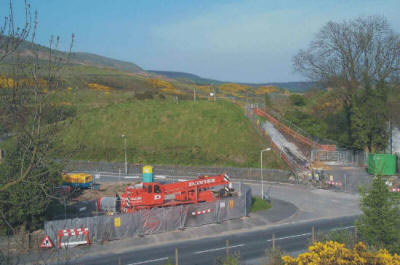
6.10.4. Policy T16 provides for a multi-modal interchange to be developed in
Bridgend town centre which will facilitate quick and easy transfer of passengers
between all modes of travel. A physical link between the bus station and the
railway station will be incorporated into the scheme which will also include a
coach, bus and taxi interchange at the existing railway station.
6.10.5. IMPROVEMENTS TO THE PASSENGER RAILWAY NETWORK
POLICY T17
LAND WILL BE SAFEGUARDED TO ENABLE THE FOLLOWING MAJOR IMPROVEMENTS TO THE
PASSENGER RAILWAY NETWORK TO BE IMPLEMENTED:-
T17(1) CONSTRUCTION OF BRACKLA RAILWAY STATION AND PARK AND RAIL FACILITY;
(Link to Map 28 West)
T17(2) IMPROVEMENT OF BRIDGEND RAILWAY STATION; (Link to Map 34)
T17(3) ENHANCEMENT OF THE MAESTEG RAILWAY LINE; AND
T17(4) FURTHER PARK AND RIDE FACILITIES AT WILDMILL, (Link to Map 21 Central) AND PENCOED STATIONS.
(Link to Map 23 West)
6.10.6. Railways share an increasing role for public transport in the UDP.
Despite their inflexibility, where they exist, railways tend to foster a sense
of continuity, and enhance the potential for development and regeneration. These
attributes have not only been recognised by the Council, but also by the South
Wales Integrated Fast Transit (SWIFT) local authority consortium, which has
consequently identified four schemes, all of which will provide additional rail
capacity to facilitate service enhancements. Details of those schemes are stated
below:-
1. Proposed Brackla Railway Station and Park and Ride Facility
6.10.7. The proposed Brackla railway station will be situated on the main
South Wales railway line from London to Fishguard. It forms a part of the SWIFT
initiative to promote seamless rail travel between Maesteg and Llanharan in
neighbouring Rhondda Cynon Taff County Borough. The station will also provide an
integrated facility that will comprise two platforms, a footbridge, cycle track
access, and a park and ride facility. The site of the proposed station has been
selected to enhance its commercial viability and to serve the public transport
needs of both the industrial estate in which it is partly situated, and the
needs of existing and proposed housing developments of eastern Bridgend. It is
anticipated that the project will be funded from developer contributions and
Transport Grant funding.
2. Improvement of Bridgend Railway Station
6.10.8. The provision of a bay platform at Bridgend station forms part of the
proposed capacity expansion of the Vale of Glamorgan railway line which is
currently used by freight traffic and for the occasional diversion of passenger
trains. The proposed capacity enhancement scheme will facilitate a daily hourly
service and a half-hourly service at peak periods. It will also provide
opportunities to increase the use of that line by freight traffic for which
purpose, the feasibility of using the Ford siding as a freight terminal will be
investigated.
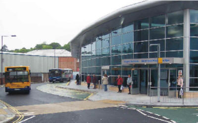
3. Enhancement of the Maesteg Railway Line
6.10.9. The Maesteg railway line is an integral part of the Llynfi transport
corridor. The line enhancement scheme will provide a passing loop to facilitate
a half hourly service, and thereby safeguard the possibility of its future
expansion for freight movement. The enhancement of the line will also complement
the Llynfi Valley Regeneration Strategy. This scheme will similarly be funded
from Transport Grant monies.
4. Further Park and Ride Facilities at Wildmill and Pencoed Stations
6.10.10. Park and Ride car parks at Wildmill and Pencoed will provide the
opportunity for an effective interchange between cars and public transport to
facilitate a reduction in the length and number of car-borne journeys especially
for the journey to work. In addition, the Wildmill park and ride will provide a
bus turning circle at the existing station which will permit bus and rail-based
park and ride operations.
6.10.11. PROPOSED PARK AND RIDE FACILITY SERVING PORTHCAWL
POLICY T18
A BUS-BASED PARK AND RIDE FACILITY WILL BE PROVIDED TO SERVE THE FUTURE NEEDS OF
PORTHCAWL. ITS LOCATION WILL BE SELECTED WITH A VIEW TO OPTIMISING THE
SUSTAINABLE TOURISM, TRANSPORTATION, SOCIAL, AND ENVIRONMENTAL OBJECTIVES OF THE
REGENERATION STRATEGY TO BE PREPARED FOR THE TOWN.
6.10.12. Land between the harbour and Trecco Bay caravan site, Porthcawl, is
designated under Regeneration Policy REG3(2) of the Plan for future
comprehensive redevelopment. A Development Brief is to be prepared as
Supplementary Planning Guidance (SPG) to the UDP, which will detail the planning
and design requirements for the Porthcawl Regeneration Area (refer to
para.
15.12.10. later). The provision of a bus-based park and ride facility,
preferably on a ‘brownfield site’, located within, and/or in close proximity to,
the Regeneration Area will form a key ‘integrated’ transportation proposal
within that Brief.
6.10.13. Such a facility will aid the diversion of car-borne journeys to and
from Porthcawl onto buses, thereby reducing congestion in the town centre. It
may reduce, to some extent, car-borne journeys to work, but its main attraction
would be its potential to intercept car-borne tourist traffic aiming for the
town centre during the summer season. Such a facility will also lessen the
pressure to expand the capacity of the local highway network in the town centre,
and reduce the demand for, or use of valuable redevelopment sites within the
Regeneration Area for the provision of car parking facilities throughout the
year. It will be necessary for the new bus-based park and ride facility to be
very carefully chosen in order that the sustainable tourism, transportation,
social, and environmental aims of the Development Brief are achieved. In this
respect, the facility will need to be accompanied by appropriate bus priority,
routing, and traffic management measures within the town in order to aid the
efficient movement of buses that will serve it. The precise location of the
facility should therefore be most appropriately determined within the detailed
context of the Development Brief for the Porthcawl Regeneration Scheme.
6.11. Public Off-Street Car Parking Provision
6.11.1. PROPOSED PUBLIC OFF-STREET CAR PARKING PROVISION – BRIDGEND TOWN
CENTRE
POLICY T19 (Link to Map 34)
LAND WILL BE SAFEGUARDED FOR THE ENLARGEMENT OF
TREMAINS ROAD CAR PARK, BRIDGEND, TO INCREASE PUBLIC OFF-STREET PARKING
FACILITIES IN BRIDGEND TOWN CENTRE.
6.11.2. The parking provision identified under
Policy T19 will complement the
regeneration objectives for Bridgend town centre. It will also serve some of the
parking needs of new town centre development which will no longer attract
generous parking provision in line with the introduction of new maximum
off-street car parking standards addressed under
Policy T8. Currently, about 60%
of the parking stock of Bridgend town centre is allocated for short-stay car
parking. As part of the strategy to increase shopper activity in the town
centre, the Council intends to increase this proportion to 80% of the parking
stock through graduated pricing. It is also the Council’s intention to improve
public transport provision to cater for the reduced long-stay parking
opportunities through measures contained in the Local Transport Plan.
6.11.3. The existing Tremains Road Car Park, and the Embassy Cinema Site,
Bridgend, (Policy R8(8) refers) are close to the main radial routes to the town
centre.
6.11.4. To deal with deficiencies to the north side of the town centre, the
existing Tremains Road Car Park will be enlarged to cater for further off-street
public car parking provision. Its management and designation as a car park will
be subject to periodic review of the Council’s charging policy and monitoring of
town centre car parks, and it will be considered further in the Local Transport
Plan.
6.11.5. The development of a new foodstore and surface level parking at the
Embassy Cinema Site (Policy R8(8) of the Plan refers) will provide sufficient
short-stay car parking to enable its use by town centre shoppers as well as
customers to the store. This will assist in reducing the current deficiency of
short-stay spaces on the north side of Bridgend town centre. The management of
the car park will be integrated with the Council’s parking strategy and an
agreement will be entered into between the Council and the store operator as to
pricing structure, and other management concerns. As with the proposed
enlargement of the Tremains Road Car Park, the management agreement will be
subject to periodic review of the Council’s charging policy and monitoring of
the town centre car parks, to ensure that it remains relevant to the needs of
the store, and the Council’s parking strategy as periodically set out in the
Local Transport Plan.
6.12. Supplementary Planning Guidance – Transportation
6.12.1. The National Assembly for Wales in its guidance document Unitary
Development Plans - Wales (2001) (para. 2.12 et.al.) advises Authorities that
while UDPs should contain policies and proposals which will provide the basis
for deciding planning applications, and for determining conditions to be
attached to planning permissions, those policies should avoid excessive detail.
Authorities should therefore consider the use of Supplementary Planning Guidance
(SPG) as a means of setting out more detailed guidance on the way in which the
policies of the Plan will be applied in particular circumstances or areas. Such
SPG can take the form of design guidance or area development briefs and should
be clearly cross-referenced to the relevant policies of the Plan which it
supplements, whilst not forming a part of the Plan itself. Appropriate
references are therefore made at several points throughout this, and other
sections of the Plan to relevant SPG as already published, and/or which is to be
prepared, submitted to (if appropriate), and adopted by the Council.
6.12.2. The Council already applies the following SPG with respect to the
transportation policies contained in its adopted development plan (1995/1997):-
- The approved South Wales Standing Conference Guidelines on Parking
Standards. (as amended from time to time); and
- The adopted former Mid Glamorgan County Council’s Design Guide for
Residential and Industrial Estate Roads.
6.12.3. Since 1997, however, a succession of government consultation papers
and policy statements have emerged on transport and associated related issues of
sustainable development. As a consequence of the new transport agenda, the
Council envisages preparing, publishing, and consulting upon revised
transportation guidelines and standards, prior to adopting updated SPG over the
currency of the UDP. For example, it will be revisiting its
Design Guide for Residential and Industrial Estate Roads to take on board
inclusive design standards for ‘access for people with disabilities’, and those
good practice pointers for ‘transport and movement’ contained in PPW (TAN) 12:
Design (2002). It will similarly be revising, in association with other local
authorities in South Wales, Guidelines on Parking moving to the endorsement of
‘maximum standards of provision’ as opposed to the current ‘minimum criteria’,
thereby reflecting the guidance contained in PPW (2002). Similarly, it will be
revisiting guidance on ‘Development Briefs for Major Development Sites’ and
‘Developer Contributions’, and thereby responding to any emerging national
guidance concerning ‘Development Tariffs’.
6.12.4. All development proposals will be expected by the Council to have due
regard to, and, wherever appropriate, conform with its up-to-date and/or adopted
transportation guidelines and standards over the Plan Period of the UDP. The
weight to be attached to its SPG guidance will become materially greater after
due processes of consultation etc. are completed, and the relevant SPG has been
adopted.
<<
Previous Chapter |
Next Chapter
>> |