|
||||||||||||||||||||||||||||||||||||||||||||||||||||||||||||||||||||||||||||||||||||||||||||||||||||||||||||||||||||||||||||||||||||||||||||||||||||||||||||||||||||||||||||||||||||||||||||||||||||||||||||||||||||||||||||||||||||||||||||||||||||||||||||||||||||||||||||||||||||||||||||||||||||||||||||||||||||||||||||||||||||
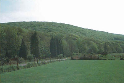
3.6.7. ‘Green Wedges’ have an important function to prevent the coalescence of settlements by maintaining an open area of countryside between them, and thereby will afford a higher degree of protection for that land which lies beyond the designated settlement boundaries. The areas identified under Policy EV11 are known to have been subject to past pressures for inappropriate development, which would have seriously prejudiced the Council’s objectives (above), and which would have seriously eroded the essential openness of the land areas concerned. Therefore, a development proposal within a designated ‘Green Wedge’ will be considered to be inappropriate in relation to the purpose of its designation unless it is for the following purposes:-
3.6.8. There may be further instances where the re-use of buildings in a designated ‘Green Wedge’ could be considered to be appropriate development provided that the proposed use(s) will not in the opinion of the local planning authority have a materially greater impact on the openness of the ‘Green Wedge’, nor conflict with the purposes of its designation. However, it is emphasised that strict control will be maintained by the local planning authority over any future extension and/or alteration of such proposals which it permits, or any use of land associated with the reused building(s). 3.6.9. Any other forms of development will be considered to be ‘inappropriate development’ unless it maintains the openness of the ‘Green Wedge’ and will not conflict with the purposes of its designation. ‘Inappropriate development’ may only rarely be granted planning permission in the most exceptional of circumstances, i.e. where other material considerations substantially outweigh the harm which that development would be expected to have on the designated ‘Green Wedge’. 3.6.10. DEVELOPMENT OUTSIDE DESIGNATED SETTLEMENT BOUNDARIES
POLICY EV12
DEVELOPMENT OUTSIDE THE SETTLEMENT BOUNDARIES OF THE FOLLOWING DESIGNATED SETTLEMENTS’ OF THE COUNTY BOROUGH WILL NOT BE PERMITTED:- THE ‘MAIN SETTLEMENTS’ OF –
THE ‘SMALLER SETTLEMENTS’ OF –
3.6.11. As a corollary to Policy EV11, and to provide further guidance to Policies H3 and H4 in relation to development within designated settlements, Policy EV12 and the Proposals Map define settlement boundaries around all of the designated settlements in the County Borough. Such boundaries were included around ‘smaller settlements’ only in the former Local Plan after it was subject to independent scrutiny at its Local Plan Inquiry, and as many of these have subsequently stood the test of Section 78 Appeals, the Council considers them to remain soundly based on environmental and planning grounds. Notwithstanding this, all settlement boundaries have been reviewed during UDP preparation, and some amendments have been made to certain ‘smaller settlement’ boundaries in this Plan. Following further independent scrutiny at the UDP Inquiry, settlement boundaries are now defined around all designated settlements in the UDP, i.e. both ‘main’ and ‘smaller settlements’. Development of the ‘main’ and ‘smaller settlements’ of the County Borough will generally be restricted to those sites which lie within the relevant settlement boundaries unless justified under Policy EV1 and other relevant Policies of the Plan.
3.6.12. RIBBON OR SPORADIC DEVELOPMENTPOLICY EV13 3.6.13. Policies EV12, H3 and H4 designate those settlements of the County Borough which the Council considers can accommodate ‘infill’, ‘windfall’ or ‘limited rounding-off’ development at a scale appropriate to the designated settlement’s individual size, character, and availability of community facilities or utility services. The Council considers that the character of all other hamlets or isolated pockets of development in the countryside should be protected by strict control over development. Accordingly, the extension of sporadic development, or its intensification there, is considered to be particularly undesirable, and unsustainable; it will cause harm to the character of the built environment and countryside, and will therefore be firmly resisted by the Council under Policy EV13.
3.7. Coastal Zone Planning and Management3.7.1. The coastline of Wales, and its off-shore marine environment, is acknowledged to be a valuable resource which must be cherished for future generations, therefore, its planning and management must be co-ordinated to be effective. To this end, the former Welsh Office set up a Welsh Coastal Forum in 1997 with a wide remit. The County Borough Council is represented on that Forum along with representatives of other local authorities, statutory agencies (e.g. the Environment Agency-Wales and Countryside Council for Wales), other Coastal Forums, off- and on-shore industries, ports authorities and landowners, Sea Fisheries Committees, and other interests. The Forum meets three times a year, and its activities are supported by the co-ordinated views of the Coastal Liaison Group ‘Arfordir’ which has a similar remit to keep under review all aspects of coastal zone management. Officers of the Council also participate in the activities of that Group. 3.7.2. Over recent years the Welsh Assembly Government has produced a series of initiatives which have sought to promote the co-ordinated and sensitive management of the coastal zone in Wales. The latest guidance in Wales is published in Planning Policy (Wales) (2002) sections 5.6 – 5.8 refers), and PG(W)TAN(W) 14 - Coastal Planning (March 1998). Each of these documents stresses the need for individual local authorities to define what it considers to be the most appropriate ‘coastal zone’ within its area. From the Government’s perspective, however, such a zone should include areas where conservation of the natural and historic environment requires development to be limited, and where visual intrusion is a matter which needs particular consideration. Therefore:- 3.7.3. DEVELOPMENT IN THE COASTAL ZONE
POLICY EV15
3.7.4. The ‘coastal zone’ of Bridgend County Borough is defined on the Proposals Map. It stretches some 13kms. from the estuary of the River Kenfig (Afon Cynffig) in the Northwest, to the estuary of the River Ogmore (Afon Ogwr) in the Southeast. For land-use planning purposes, however, the seaward limit of the ‘coastal zone’ must be the mean low water mark. Although proposals located between mean high and low water marks are outside the Council’s responsibility as the local planning authority, its planning policies, nevertheless, should be taken into account by the range of sectoral, including government, regulators which exact control over the coastal and marine activities and development within that area. Similarly, the Council has an increasing interest in any off-shore developments whose visual and physical characteristics may have an indirect on-shore dimension or impacts on the area over which it exercises its direct planning control.
3.7.5. The inland boundary of the ‘Coastal Zone’ has been defined to include the whole undeveloped coastline of the County Borough, and its setting; together with the developed areas of Porthcawl which are visually and physically continuous with the coast, and which portray strong maritime characteristics and associations, e.g. the existing holiday caravan parks and the sea-front areas of the resort. 3.7.6. Proposals within the Glamorgan Heritage Coast must, in the first instance, satisfy the requirements of Policy EV9 otherwise they will not be permitted. However, proposals must also satisfy the provisions of Policy EV42 where they impinge on the nationally important historic landscapes, parks and gardens within the County Borough. Similarly, the need for a coastal location of a proposal in the Coastal Zone should be clearly demonstrated, especially where that development is proposed in an undeveloped part of the Coastal Zone. This reflects Government policy that UDPs should aim to protect and enhance the character and landscape of such areas and that coastal locations should only be proposed for developments which need to be located on the coast. New coastal developments will not be permitted where they entail the construction of large scale engineering works to protect them on land subject to sea-erosion, or to defend land which might otherwise be susceptible to inundation, as this may introduce undesirable and alien features into the much-valued coastal scene and could transfer the risks of inundation to other areas. 3.7.7. In the case of new coastal defence works, the Council will take into account all potential on- and off-shore environmental effects of proposed works which are subject to planning consent. The latter interests together with those factors such as the potential visual and physical impact of new development will be particularly important where proposals are considered by the Council within the developed area of the ‘Coastal Zone’, i.e. Porthcawl, where opportunities for restructuring and regenerating the urban area have already been identified in the Resort’s Regeneration Strategy. If new development requires a coastal location it will generally be better sited within the developed coastal area where such opportunities exist, provided due regard is paid to the additional risks of erosion, flooding or land instability which may be exacerbated by the action of the sea. 3.7.8. It is stressed, however, that within the ‘Coastal Zone’ the process of coastal planning and coastal management are not synonymous. It is the function of the policies of this UDP to guide the operation of the statutory planning system in the ‘Coastal Zone’ of the County Borough, which is a clearly defined role; whereas coastal management also involves matters which are not necessarily concerned with land use, that arise through other functions of the Council and/or its neighbouring local authorities, or through the powers and activities of other bodies which have a coastal remit e.g. the National Assembly or other Central Government Departments. Policy EV15 is criteria-led, and is designed to be all-embracing with respect to control of development in the ‘Coastal Zone’ as a whole in the County Borough. The Council will also take on board the interests of adjacent, and other coastal management bodies in its implementation. 3.7.9. In December 1998 the Council resolved to begin preparation of a Management Plan, the aim of which will be to co-ordinate all efforts for the day to day management of the ‘Coastal Zone’ of the County Borough.
3.8. Flood Risk and Water Pollution3.8.1. The Council recognises the need to co-ordinate its own environmental planning activities with those of the Environment Agency Wales in order to prevent the risk of flooding, and to avoid pollution of the water environment and water resources in the County Borough. 3.8.2. Whilst protection of the water environment is a primary function of the Environment Agency Wales, this can only be achieved by a close co-operation with the Council. Relevant Guidance draws the attention of those local authorities with a coastline to the need to manage their coastal zone, to consider the nature of coastal geology and landforms, and to establish where there are risks from flooding, erosion by the sea, and landslips. Whereas it is the function of the EA Wales to protect people and property from flooding by either rivers or inundation by the sea, the Council (as local planning authority) should avoid putting further development at risk by including appropriate policies in its UDP, as well as acting where appropriate as the flood defence authority. The Ewenny, Ogmore, Llynfi and Kenfig are all statutory ‘main rivers’ within the County Borough and the former three rivers each have flood warning stretches supplemented in the case of the Ogmore and Ewenny rivers by Agency flood defences. There is also Agency flood defence measures against coastal inundation between Newton and Merthyr Mawr Warren. In recent years the Council has also undertaken substantial coastal defence improvements at Porthcawl and lesser works at Rest Bay. 3.8.3. The flood defence policies of the EA Wales for river and coastal flood plains were published in March 1997 and are shared by the Council, as they establish clear objectives to ensure development:-
3.8.4. DEVELOPMENT IN AREAS OF FLOOD RISKPOLICY EV16
3.8.5. Many of the planning policies contained in the former development plan complied with the aims set out in para 3.8.3. However, the Council has reviewed all of those policies during the preparation of the UDP especially in the light of the EA Wales’ Section 105 Flood Risk Maps and, wherever necessary, former policies have been amended or, in some instances deleted, to reflect:-
3.8.6. The Council and the EA Wales will therefore resist inappropriate development within floodplains where such development would itself be at risk from flooding or may cause flooding elsewhere. Risk to life is of paramount concern in relation to any development in areas at risk from flooding, but especially for residential development in tidal (including estuarine) and coastal locations. Development proposals should avoid committing future generations to inappropriate options for flood defence as this would be in direct conflict with the aim of sustainable development. It should always be remembered that flood defence works are an intervention measure in natural processes, therefore a balance has to be struck between maintaining and supporting natural floodplains with their invariably rich natural biodiversity, and reducing flood risks. 3.8.7. Therefore, all new development sites proposed in the UDP have been assessed by the Council using data supplied by the EA Wales, but that assessment should only be regarded as the starting point for more detailed scrutiny of future proposals by the Council and the EA Wales, i.e. when planning applications are submitted for development.
3.8.8. It is essential that any surface water which is proposed to be discharged into existing watercourses should not give rise to flooding because those watercourses lack the spare capacity to accommodate it. In some instances, where new development is proposed, it will be necessary for developers to undertake temporary remedial works for the provision of on-site storage of water or run-off, until a permanent solution can be achieved in the area in question. In other cases, where the discharge of additional surface water is likely to create flooding, or exacerbate existing problems of unsatisfactory drainage, new development may only be permitted by the Council where appropriate alleviation measures are taken in advance of development to satisfactorily overcome that problem. In instances involving the latter, applicants will be expected to include all necessary land in their development proposals in order that satisfactory solutions to those problems can be achieved through the imposition of the appropriate planning conditions. 3.8.9. Where the relevant alleviation measures, as referred to above, cannot be satisfactorily secured and undertaken for proposed development, the Council (acting on the advice of the EA - Wales) will refuse planning consent for such proposals. 3.8.10. Strategic water supplies to the County Borough are generally provided by means of trunk water mains from sources outside the County Borough (as set out in the Energy and Utilities Chapter later), however, there are also local water sources which must be protected from pollution. Similarly, there are several reaches of streams and rivers in the County Borough which remain polluted to varying degrees from past industrial, domestic or agricultural practices and activities, but these are being progressively improved over time to provide for increased biodiversity in terms of species and habitats for wildlife. The EA Wales’ Local Environment Agency Plan (LEAP) for the Neath, Port Talbot and Bridgend Area advocates an integrated environmental approach to local planning for sustainable development especially with regard to water resources, flooding, pollution, waste, conservation and recreation. Therefore:- 3.8.11. DEVELOPMENT AFFECTING WATER QUALITY AND SOURCESPOLICY EV17 3.8.12. The LEAP for the Bridgend area records four licensed groundwater abstractions for industrial purposes in the Kenfig and Ewenny river catchments; five licensed abstractions of surface water for industry in the Kenfig, Llynfi and Ewenny catchments; a single licensed abstraction of surface water for public consumption in the Ogmore valley near Gilfach Goch; and a further licensed abstraction of groundwater for public consumption at Schwyll to the south west of Bridgend. The number of abstractions for public consumption has been progressively reduced in recent years by Dwr Cymru/Welsh Water and the Schwyll source is now reserved for emergency use only. Notwithstanding the latter, it is essential that the groundwater resource at Schwyll is protected, and as it is rapidly recharged from surface waters in the lower part of the catchment it is susceptible to any major local pollution event within that catchment. There is also increasing public concern over the degree of pollution which may arise through the run-off from treated farmland in the County Borough into adjacent watercourses which ultimately discharge into ‘main rivers’. 3.8.13. Conversely, those development proposals which it can be demonstrated will lead to material improvements to the quality of water in drains, streams, rivers and other surface water features within the County Borough, will make a positive improvement to both the local and off-shore coastal environment, and should lead to increased biodiversity and quality of life, and will be favoured by the Council.
3.9. Biodiversity and Nature Conservation3.9.1. Over the passage of time, truly natural environments are becoming increasingly rare as mankind has adapted the landscape to supply its needs, and nature has adapted to our management of the land; but much of the nation’s biodiversity is dependent on the continuation of traditional techniques of land management, which has collaborated with natural processes to produce the rich mosaic of fauna, flora, geological and topographical features which exists today. When species and habitats are lost, the ability of our own and future generations to experience and enjoy nature is devalued, and the genetic pool of resources available for natural evolution is diminished. 3.9.2. The protection of the physical environment and ‘biodiversity’ are therefore central concerns of planning policy, and represent high priorities for consideration along with landscape conservation (see earlier) in the UDP. The promotion and conservation of ‘biodiversity’ i.e. ‘the variety and richness of life forms’, is therefore an essential element in delivering the Council’s Local Agenda 21 Strategy, and is specifically addressed in its approved Local Biodiversity Action Plan, each of which will continue to inform the policies of the UDP and its future Reviews. 3.9.3. As Welsh Planning Guidance advises, the Government has signed and ratified the Convention on Biological Diversity and is therefore committed to conserving, and where possible, enhancing biodiversity. It is therefore national planning policy to protect the nature conservation interest of statutorily designated sites, and to sustain or enhance the biodiversity of the wider countryside.
3.9.4. Prior to, and since the production of Biodiversity: The UK Action Plan, the Government’s nature conservation policies have largely been implemented through The Wildlife and Countryside Act 1981. The Act provides for the protection of endangered species of animals and plants and for the protection and management of important habitats. The latter are generally classed along with other sites of national geophysical, geomorphological, and geological interest, as Sites of Special Scientific Interest (SSSIs). This is acknowledged in the UDP by Policy EV18:- 3.9.5. DEVELOPMENT AFFECTING INTERNATIONAL AND NATIONAL SITES OF IMPORTANCE FOR NATURE CONSERVATION AND SCIENTIFIC INTEREST
POLICY EV18
NOTWITHSTANDING THE ABOVE, THE COUNCIL WILL CONSIDER THE USE OF PLANNING CONDITIONS OR PLANNING OBLIGATIONS/ AGREEMENTS TO SECURE ANY COMPENSATORY MEASURES NECESSARY FOR PROTECTING THE FEATURES OF THE SITE WHICH HAVE CAUSED IT TO BE DESIGNATED PART OF THE NATURA 2000 NETWORK. (B) DEVELOPMENT PROPOSALS WHICH WOULD ADVERSELY AFFECT A NATIONALLY DESIGNATED SITE FOR NATURE CONSERVATION, GEOLOGICAL, OR GEOMORPHOLOGICAL INTERESTS WILL BE PERMITTED ONLY WHERE:-
3.9.6. The incorporation of the Habitats Directive (92/43/EEC) into British law and the resultant Conservation (Natural Habitats & etc.) Regulations 1994 now afford much greater protection to designated sites of nature conservation importance. Planning Policy Wales (PPW) (2002) Sections 5.1 – 5.5 and TAN(W) 5 ‘Nature Conservation and Planning’ (November 1996) also offer clear guidance for UDP preparation. Namely, that sites statutorily designated for their nature conservation importance, i.e. Sites of Special Scientific Interest (SSSIs), National Nature Reserves (NNRs), Special Protection Areas (SPAs), Special Areas of Conservation (SACs), Ramsar sites and potential SPAs and SACs and any listed but undesignated Ramsar sites should be identified in UDPs. There are no existing or proposed SPAs or Ramsar sites in Bridgend CB. 3.9.7. Policies EV18(A) and EV18(B) of the Plan seek to protect statutorily designated sites of international or national importance. These policies of the Plan, and future development control decisions should therefore reflect the relative significance of the site for nature conservation, placing particular emphasis on the protection of internationally important sites. In this respect, the Kenfig NNR and the Merthyr Mawr proposed NNR, both of which are also SSSIs, generally constitute the Kenfig (candidate) cSAC. It should be emphasised that a cSAC having been identified as a site of European importance by the Government and the European Union attracts the same legal protection as if it had already been designated as such. Two further cSACs in the County Borough have also been put forward by CCW to the European Commission i.e. the Blackmill Woodlands cSAC and the Cefn Cribwr Grasslands/Glaswelltiroedd Cefn Cribwr cSAC. These designations are shown on the Proposals Map, and represent the ‘highest tier’ of sites of importance for nature conservation in the County Borough. 3.9.8. Development proposals affecting those sites will be rigorously examined under Policy EV18(A) and must meet its strict criteria, otherwise they will not be permitted. An Environmental Impact Assessment (EIA) will usually be required by the local planning authority to determine whether a proposal is likely to have an adverse effect on internationally important sites, and the comments of the CCW as the statutory advisor on nature conservation matters will be material to its consideration. Legislation provides that where it appears that development would have an adverse effect upon those sites, the Council is not able to grant planning consent for such a proposal, but must either refer it to the National Assembly for Wales, or refuse it. 3.9.9. The Natura 2000 network is the cornerstone of the EU’s nature conservation policy. The Habitats Directive provides for the creation of a network of protected areas across the EU to provide for an effective system to prevent the capture, killing, injuring, or damaging and disturbance of certain endangered species. The designation of SACs aims to maintain or restore the extent and quality of rare habitat types, and to ensure that rare species can survive and maintain their populations and natural range on a long term basis. This holistic approach is also necessary to secure biodiversity, and to understand natural systems from a wider and more sustainable viewpoint, thereby taking into account other scientific, economic, social, cultural and regional requirements. Therefore, even where it has been clearly demonstrated that a proposal will not adversely affect a site of international significance for nature conservation, it will remain the policy of the Council to secure through planning conditions and/or the appropriate planning obligations/agreements any compensatory measures necessary to retain the overall coherence of the nature conservation sites known as Natura 2000. 3.9.10. The sites identified as being of national importance for nature conservation in Bridgend County Borough are:-
(N.B. Some of these sites (or parts of them) are themselves now also of international (European) importance for nature conservation – see above.) All of the sites referred to above are also shown on the Proposals Map. Any further sites designated by the CCW as SSSIs during the currency of the UDP will be subject to the same scrutiny under Policy EV18(B) of the Plan. 3.9.11. Development which affects a site of national importance for nature conservation, i.e. an SSSI, will be subject to special scrutiny to establish any potential or indirect effects upon those sites. Where potential impacts remain unknown, a ‘precautionary approach’ will be followed by the Council weighted in favour of the preservation of those sites. Full regard will be given to Government advice and policies relevant to a site’s status, its intrinsic value, and its value to the national network of such sites. Where an overriding need for a proposed development is claimed, the onus is firmly placed on any potential developer and/or owner to clearly demonstrate the case for the site’s development, and why development should not be located elsewhere on a site of less significance to nature conservation. Sensitive design in conjunction with appropriate planning conditions and/or planning obligations/agreements will be pursued by the local planning authority with a view to overcoming potential adverse impacts on the environmental resource, and to ensure protection and enhancement of a site’s nature conservation interest. Where the site concerned is a NNR or a site identified under the Nature Conservation Review (NCR) or Geological Conservation Review (GCR), particular regard will be paid to its national importance. In assessing such proposals the Council will show that:-
3.9.12. DEVELOPMENT AFFECTING LOCAL OR REGIONAL SITES FOR NATURE CONSERVATION, OR REGIONALLY IMPORTANT GEOLOGICAL OR GEOMORPHOLOGICAL SITES (RIGS)POLICY EV19
3.9.13. In order that an holistic approach is taken to nature conservation and/or areas of scientific interest in the County Borough a second tier of protection is necessary to protect those sites defined in the UDP as being of regional or local importance. PPW (2002) advises local planning authorities to have regard to the relative significance of international, national and local designations in considering the weight to be attached to nature conservation interests, but it does not recognise any regional level of importance of sites. The Strategic Guidance agreed by the SE Wales Strategic Planning Group fills this potential vacuum by clearly indicating that whilst the weight of protection which should be given to sites of regional or local significance should be less than that for the ‘top tier’ sites, the need to maintain them as protected features must be clearly outweighed by other material considerations to overturn the presumption in favour of their protection, but this must be assessed on the merits of each proposal and the relative importance of each site. 3.9.14.These regionally and locally important sites, which include all designated Local Nature Reserves (LNRs), Sites of Importance for Nature Conservation (SINCs), and identified Regionally Important Geological or Geomorphological Sites (RIGS) are vital to biodiversity and the conservation of scientific interest in those areas in SE Wales, since the statutory designations are too few to conserve the wider biodiversity and scientific resource. There are, for example, a large number of such ‘second tier’ sites which, although meeting SSSI standards, will for a variety of reasons never be notified as such. All of these sites are addressed in the Council’s adopted Local Biodiversity Action Plan (LBAP), which offers Supplementary Planning Guidance (SPG) to assist in the planning and management of those sites. Those SINCs already included in the Council’s LBAP have been validated on a scientific basis prior to their inclusion in that document, and any additional sites to be promoted will go through the same process of validation before inclusion in any future review of the LBAP. All existing and proposed LNRs and RIGS are shown on the Proposals Map of the UDP; however, in the interests of clarity, and in view of their number and variety in terms of scale, SINCs are excluded from the Proposals Map. Full details of the latter are already included in the Council’s LBAP as Supplementary Planning Guidance to the UDP. 3.9.15.Where development is considered to outweigh protection of these regionally and locally important sites, developers must demonstrate that every attempt has been made to minimise impact on the site and/or to provide compensatory or mitigation measures for any loss of the site, its biodiversity or its scientific interest. Proposals must also include measures for the longer term maintenance of the site (including any habitats) to ensure that they remain sustainable. In respect of biodiversity, the contents of the future RBAP or LBAP will represent major considerations in determining the propriety of impact mitigation or replacement of any site subject of Policy EV19. 3.9.16. A common approach to landscape evaluation is also important to the conservation of biodiversity and scientific sites. Policy EV9 sets out strict measures to control development which would adversely affect, or which would be visually intrusive upon, the natural beauty of the nationally important landscape of the Glamorgan Heritage Coast. Policy EV10 similarly sets out the measures to control development which may adversely affect, the designated ‘Special Landscape Areas’ of the County Borough. The latter were designated through the former Local Plan but have been reassessed in the UDP. However, the South East Wales Strategic Planning Group has agreed that it is desirable in the longer term to move towards the adoption of a common approach to landscape evaluation in the sub-region. This approach will take into account the findings of all future RBAPs and LBAPs thereby assisting in defining the nature of the landscape (including the social, economic and cultural traditions which have remodelled it), its physical and visual attributes, and its intrinsic importance to biodiversity and scientific interest. 3.9.17. Such a consistent definition of landscapes and sites is not possible throughout SE Wales at present ‘due to the current stage of evolution of plans and the lack of detailed knowledge of distributions’. In December 1998, the Council agreed to participate in a consortium of local authorities comprising Bridgend, Caerphilly, and Rhondda-Cynon-Taff CBCs to progress such a project in their geographical areas using the LANDMAP methodology for landscape assessment, as recommended by the Countryside Council for Wales (CCW). Such a multi-purpose assessment which will include the many facets of the landscape will provide a clearer future context for the preparation of UDPs, assessment of the biodiversity and scientific interest of the landscape, and the preparation of the Council’s future Coastal Zone Management Plan and intended Landscape Strategy, together with the review of its existing Countryside Strategy and Integrated Action Programme.
3.9.19. THE GENERAL PROTECTION OF BIODIVERSITYPOLICY EV20
3.9.20. It is essential that a balance is achieved between the need for development and the need to protect existing habitats and species which contribute to the general biodiversity of the County Borough. It is the aim of Policy EV20 to achieve that balance between the location, design, and layout of development or redevelopment, and the need to conserve that site’s biodiversity, whilst also taking into account the interests of any adjacent nature conservation resource(s). Every opportunity should also be taken to record important biodiversity features within a site prior to their displacement and ongoing management, or in the worst case scenarios, before such features may be permanently lost. The latter situation will, however, be avoided wherever possible by the Council requiring any appropriate mitigation and compensatory measures in order to secure the future biodiversity of those sites. These will be secured, wherever appropriate, by means of planning conditions and/or planning obligations/agreements with developers. In all respects, the main aim should be to reverse any previous fragmentation and to prevent any further isolation of key species and habitats, thereby maintaining and enhancing ecological networks in the County Borough. Further clarification of this aim is contained in Paragraph 37 of the Conservation (Natural Habitats, & etc) Regulations 1994. 3.9.21. All authorities in SE Wales are pursuing the development of LBAPs, sometimes within co-ordinated frameworks within the sub-region. Work on those Plans has already demonstrated the importance of wildlife corridors (especially river banks) and networks of a very large number of features which are essential to the success of fauna and flora, but as noted in the Strategic Planning Guidance for SE Wales, these cannot be designated as protected sites for some time. However, in the meantime, it has been agreed that local authorities should work towards this approach.
3.9.22.The protection and enhancement of wildlife corridors and networks is considered to be essential to secure the longer term protection of biodiversity in the County Borough. Development proposals must therefore take into account, and should not adversely affect, the integrity or continuity of existing landscape features, landforms and habitats of importance to local fauna and flora. The Council will therefore expect potential developers to provide for the necessary ongoing conservation/management of wildlife corridors in their development proposals, and, as a last resort, provide for the local replacement of those features which support and provide corridors for wildlife. It would prefer to secure any appropriate conservation/management measures through negotiation, however, where necessary, they will be assured through the imposition of appropriate conditions on planning consents, or by the conclusion of suitable Planning Agreements/Obligations. Such features of importance will vary from site to site, and from one part of the County Borough to another, however, the following are recognised as being of general significance as potential wildlife corridors:-
3.9.23. Schedules 5 and 8 of the Wildlife and Countryside Act 1981 and Part III of the Conservation (Natural Habitats & etc.) Regulations (1994) give special protection to a wide range of animals and plants and introduces penalties for disturbing their habitats. The protection of these species is not confined to designated areas, but rather, must be taken into account wherever a planning application may affect those species and their habitats. The species protected by the above legislation are listed in CCW’S Species Conservation Handbook GEN1 (Apps 3 and 4) and GEN4. 3.9.24. The protection afforded by the relevant statutory species protection provisions referred to above not only applies to proposals for new development, but will also apply to conversions of existing buildings in towns, the countryside, and those on the edge of settlements. Therefore, all applicants for planning permission must conform with those provisions, and consultation with the CCW will ensure that proper consideration is given to them. Similarly, all transportation and utility service developments e.g. the construction of underpasses, or the removal of old bridges and small culverts/drains, which may provide valuable nesting sites to small mammals (including bats), birdlife, and wild plants, must also consider these matters. The provision of nesting boxes for barn owls or roosts for bats, for example, in barn conversions can conserve these species at their existing habitats with a minimal additional cost upon the design of such developments. 3.9.25. Woodland, individual and small groups of trees, and hedgerows are an integral facet of biodiversity, and as such, make a particularly beneficial contribution to the natural and built environment. Areas of woodland can similarly be a significant feature in the landscape, provide opportunities for local nature conservation, and may lessen the impact of air pollution and thereby assist in redressing the process of global warming and climate change. It is important, therefore, that development or other activities which may be detrimental to trees and nature conservation should be minimised, and for planned management of the County Borough’s woodland and forestry resources to be encouraged. It is also important that the general public are able to enjoy the amenity and educational opportunities which trees and hedgerows can provide in the context of the urban and rural environment, but in a manner which will not adversely affect either the resource, or its surroundings. To this end, controlled access to, and the implementation of, countryside management projects are often necessary or expedient in order to protect the environment. Therefore:- 3.9.26. THE PROTECTION/ MAINTENANCE OF BROAD- LEAVED TREES ETC.POLICY EV21
3.9.27. Native broad-leaved woodland and hedgerows are significant elements of the landscape of the County Borough, and provide valuable habitats and routeways to wildlife. Ancient, semi-natural woodlands, as defined in the Glamorgan Inventory of Ancient Woodland - produced by the former Nature Conservancy Council (now CCW) in 1986, are of particular importance to biodiversity. It is also important that trees which make an important contribution to the landscape (whether these are individual specimens, groups or areas, or more substantial woodland) continue to be protected by tree preservation orders for their amenity value in urban and rural areas, and that important trees on development sites and within existing amenity areas are protected. 3.9.28. It is therefore important that broad-leaved native trees or hedgerows are replaced when lost, to preserve their contribution to amenity and biodiversity, especially where those species are interdependent on their habitats. The Conservation (Natural Habitats & etc) Regulations 1994, and Hedgerow Regulations 1997 support this approach, and particularly recognise the value of small woods and traditional field boundaries such as hedges, for the migration, dispersal and genetic exchange of wild species. The National Assembly for Wales has produced a strategy document entitled Woodland Strategy for Wales which seeks to ensure that the future for Welsh woodland is sustainable. Policy EV21, and the ensuing Policy EV22 will each contribute towards achieving the overall aims of the NAfW’s woodlands strategy. 3.9.29. Policies EV20 and EV21 are intended to provide a general context for the retention of trees and hedgerows in developments. However, ‘ancient semi-natural woodland’, which has existed since before 1600, is an irreplaceable asset to local biodiversity in the County Borough, as it contains unique habitats and species which take centuries to become fully established. The planting of a greater number of trees may, under certain circumstances, be an adequate replacement in mitigation for the loss of some trees and hedgerows due to development. The1990 Act places a duty on local planning authorities to make adequate provision where appropriate for the preservation/planting of trees when granting planning permission by imposing conditions and/or making Tree Preservation Orders (TPOs). It is not reasonable, however, to use conditions to secure long term protection when TPOs can be used. A TPO can also be used to protect and secure the replacement of trees which are to be planted to fulfil conditions. 3.9.30. The principal effect of a TPO is to prohibit the cutting down, uprooting, topping, lopping, wilful damage or wilful destruction of a tree or trees, without the consent of the local planning authority. The terms tree or woodland are not defined in the Act, nor does it limit the application of TPOs to trees of a minimum size, but for the purposes of the Act the High Court has held that a tree is anything which ordinarily one would call a tree. A TPO cannot therefore be made on bushes, shrubs or hedges, although it may be made to protect trees in hedges or an old hedge which has become a line of trees. The Hedgerow Regulations 1997 which protect specifically hedges came into force in June 1997.
3.9.31. A local planning authority may make a TPO where it considers that it is expedient to do so in the interests of amenity. Welsh Planning Guidance on the scope of TPOs and how they should be applied is contained in TAN 10 - Tree Preservation Orders (October 1997). The Council will also have regard from time to time to advice on trees issued by the Arboricultural Association. Further advice on the effect which development proposals may have on trees and hedgerows, and with respect to tree planting on development sites, is published by the Council in its Supplementary Planning Guidance - Trees and Development which should be fully taken into account by developers when submitting planning applications. Trees in Conservation Areas are subject to similar controls as trees to which a TPO applies, and guidance on this will similarly be found in TAN 10 (para 13 refers). 3.9.32. There are extensive tracts of land (including forestry) within the County Borough which are within the control of the Duchy of Lancaster (i.e. constitute Crown Land) and/or where the Forestry Commission Wales has an interest. A TPO may be applied to protect trees on Crown Land only with the consent of the appropriate authority - in this case the Duchy, however, there is a provision in the Act to make an Order in anticipation of such land being transferred to a private interest. Similarly, there are limitations to the making of TPOs on land in which the Forestry Commission Wales ‘has an interest’. If the Commission has made a grant in respect of the land, it must give its consent before a TPO can be made. However, both the Duchy and the Commission have strategies for sustainable development, and therefore promote long term commitments for the creation, development and management of forests as a renewable resource. 3.9.33.The Council supports such a strategic approach by the above bodies, as it lends itself to be integrated in holistic terms with its own proposed Landscape Strategy. 3.9.34.There may also be instances where although trees may be present which merit protection on amenity grounds, it may not be expedient to protect them by TPOs, for example, where such trees are under good arboricultural management, or where there is little risk of them being felled or lopped etc. 3.9.35. AFFORESTATION PROPOSALSPOLICY EV22
3.9.36. Afforestation can offer a number of benefits such as recreational opportunities, reduction of timber imports, job creation, site (including slope) stabilisation, landscape improvements and improve the water environment. In addition, increased tree planting has been recognised as having a potentially beneficial impact for the reduction of greenhouse gases (especially Carbon Dioxide). Whereas management practices have improved since the 1980’s, unrestricted commercial forestry has the potential to change the character of the landscape, and can have an adverse impact on agriculture and biodiversity. 3.9.37. Forest owners and managers, e.g. Forestry Commission - Wales, are encouraged to take a longer term, more strategic view of the management of woodlands. The Council, as a statutory consultee on the Commisions’s Forest Designs Plans, fully endorses that policy. Forestry is essentially a long term industry, and as such, strategic policies are required in order that afforestation proposals can be assessed in terms of whether they maintain and/or enhance other important countryside features. In this respect, the guidelines issued by the Forestry Commission provide an important means of examining the extent to which those proposals can be integrated with their surroundings, or conversely, where large scale felling may be controlled with a view to mitigating landscape devaluation, soil erosion and/or the loss of habitats important to biodiversity in the County Borough. 3.9.38. It is similarly desirable that Plans for existing or former conifer plantations and new afforestation proposals incorporate an increase in broad-leaved tree species, as opposed to shorter term timber crops, as well as managed recreation schemes in forest areas. There are also opportunities to provide for biomass cultivation as a source of renewable energy, and for the planting and management of coppices which encourages biodiversity, and maintains a local cultural and historic tradition. All of the above practices and the need for co-ordinated management of Wales’ forestry resource are also addressed in the NAW’s strategy document - Woodland Strategy for Wales.
3.10. Environmental Quality, Land Reclamation, Derelict and Contaminated Land3.10.1. It has often been stated that a key challenge to sustainability is Environmental Quality which implies a degree of ‘eco-innovation’. For towns and villages of the County Borough, this implies the benefits which could be gained by promoting mixed-use neighbourhoods which have several social and environmental advantages, especially: closer linkages between jobs and homes, more use of public transport, walking and cycling, lower levels of car ownership and use, and more support for local retailers as opposed to out-of-town centres. Essentially, the promotion of sustainable neighbourhoods within towns and villages is about local empowerment i.e. local people achieving local solutions to local problems and thereby improving the quality of their local environment and attaining a better quality of life. 3.10.2. In the countryside of the County Borough, similar benefits can be gained through sensitive measures for countryside management, farm education, environmental improvements, the removal of fly-tipping and other results of vandalism and pollution, whilst realising the recreational opportunities through walking, riding and cycling and the enjoyment of the natural environment. 3.10.3. COUNTRYSIDE MANAGEMENT AND URBAN ENHANCEMENTPOLICY EV23
3.10.4. Although the Council does not itself have significant resources to undertake a large number of projects of the nature described above, it seeks to encourage landowners, and other statutory and voluntary agencies in the formulation and implementation of appropriate proposals within the County Borough. The involvement of the wider community in the development and management of such projects, especially in those urban and rural areas which display characteristics of social deprivation, can forcibly reverse decline, reduce social exclusion, and lead to improvements in the environmental quality of life thereby contributing to sustainable development. 3.10.5. The Council’s approved Countryside Strategy and Integrated Action Programme offers further Supplementary Planning Guidance on such projects, co-ordinates proposed management actions for statutory and non-statutory sites of importance to nature conservation, and supports local area-based schemes e.g. woodland projects, agri-environmental schemes and other recreational-based initiatives. Integrated management initiatives should extend into towns and villages thereby connecting the urban dweller with the countryside, and mitigating the impact of settlements on their adjacent countryside. 3.10.6. Public awareness and interest in their environment has grown considerably in recent years. Whilst a great deal has been done by the public and private sectors to achieve environmental improvements, for example, the reclamation of former colliery sites, tips and workings, some areas of dereliction remain. Smaller areas of underused and unsightly land also exist in the County Borough, and the Council remains fully committed to its remediation (including, where necessary decontamination) to provide redevelopment opportunities or the creation of new amenities. Similarly, the design and form of new development, or redevelopment, schemes must be carefully considered through design or development briefs for major sites (see later).
3.10.7. The quality of the environment is considered to be an essential element in enhancing the attractiveness of the County Borough and to provide for increased quality of life for its residents. Environmental enhancement or improvement schemes, which will often involve some degree of clearance, landscaping, paving, seating tree planting etc. improves the appearance of sites and raises the visual amenity of neighbourhoods. For example, the Council supports the Greening the Valleys partnership with the Welsh Development Agency, Countryside Council for Wales, Environment Agency - Wales and others, which aims to improve the landscape of the valleys. As far as resources permit, the Council also undertakes schemes on land within its ownership and, where appropriate, on other land. Wherever possible, it will continue to explore the available avenues for resources to fund such projects especially in conjunction with the private sector. 3.10.8. Land reclamation is recognised as a key step in the regeneration process of an area. Welsh Planning Policy Guidance advises that derelict and waste land should be restored and, where possible, brought back into beneficial use. In this respect, preference will be given to the development of derelict and waste land, as opposed to the development of greenfield sites. 3.10.9. LAND RECLAMATION AND ENVIRONMENTAL IMPROVEMENTPOLICY EV24
3.10.10.The WDA funds private and public sector land reclamation schemes. Private schemes are assessed on their individual merits. Local Authorities submit a list of schemes to the WDA for approved funding about every 2 years. The Agency prepares a rolling programme for sponsored land reclamation schemes which will now be subject to the scrutiny of the National Assembly. Their programmes take account of the resources expected to be available, and of the funds already committed over the programme periods. Initial bids to the WDA include a description of the land concerned, the reasons for reclamation, proposals for land acquisition, preliminary cost estimates and proposed after-uses for the schemes as well as the authority’s views regarding their priority. 3.10.11.The WDA sets out its general policies for landscape issues and for the implementation of area landscape strategies and improvement schemes in its document: Landscapes Working for Wales. Its more local strategy for environmental improvements is detailed in Landscapes Working for Bridgend County Borough which was commissioned in partnership with the former Ogwr BC. The strategy advocates an Action Programme of 53 prioritised landscape schemes which can be implemented primarily by the Council, but also by other agencies. 3.10.12. It is the WDA’s objective to complete the ‘environmental renaissance’ of the South Wales Valleys through initiatives such as Greening the Valleys, and to stimulate economic development in the Coastal Development Area of South Wales, as ‘Priority Investment Areas’; whereas the area astride the M4 and Inter City Rail Corridor through the centre of the County Borough forms part of a ‘Principal Gateway and Corridor’ into Wales, which qualifies it as being a ‘Secondary Investment Area’. 3.10.13. RECLAMATION OF DERELICT AND OTHER LANDPOLICY EV25
3.10.14. The Council supports the WDA in its initiative to ‘add value’ to its successful land reclamation programme through further environmental investment. Notwithstanding this, it also recognises that many ‘derelict sites’ - notably coal shale tips and mine working areas - have become naturally revegetated over time and are often attractive landscape features in their own right, and may host significant biodiversity. Similarly, some former reclamation schemes may no longer measure up to current landscape expectations and will require a review to ensure certain habitats and visual amenity. There is now a need to integrate reclamation activities with other environmental concerns including the conservation of industrial archaeology and sites of interest for their biodiversity. The latter should be achieved through the submission and approval of Site Development Briefs, and the conclusion of any appropriate Planning Obligations/Agreements to the satisfaction of the local planning authority. 3.10.15. Each Site Development Brief shall include detailed land use policies for the land reclamation site and will be treated as Supplementary Planning Guidance (SPG) to Policy EV25 of the Plan after it has been approved by the Council. 3.10.16. The aftercare requirements of schemes can often pose major problems. This is partly due to the increasing number of schemes where a high proportion of the reclaimed land is proposed for amenity or agricultural and forestry after-use. Once treatment has been completed, it is customary for local authorities to dispose of the land as soon as possible. However, certain land must be retained in public ownership as a result of its designated after-use; for example, public open space. Also, where agricultural or forestry uses are proposed, before disposal can occur, the local planning authority must be satisfied that the prospective landowner has the capability and resources to maintain the site to an adequate standard. 3.10.17. Therefore, concerning land which will have to remain in public ownership, there is a need for the Council to monitor conditions and to take appropriate action to ensure that reversion to dereliction does not occur. The most effective means to achieve this is through after-care management proposals, which should preferably be included from the outset in the Site Development Brief. Appropriate planning conditions will therefore be attached to consents for development in accordance with the provisions of the pre-approved Site Development Briefs and, where necessary, any additional requisite Planning Obligations/Agreements which will address the fair and reasonable direct and indirect infrastructure requirements of the site as well as mitigating any adverse environmental, social or economic impacts of the proposed development on the community, to be agreed with the local planning authority. The land use issues to be addressed should always include the effective design of land-form, landscape, and location of facilities. 3.10.18. Contaminated Land is defined as:- .....land appearing to a local planning authority to be in such a condition by reason of substances in, on or under land, that harm is or is likely to be caused to living things, or to property. 3.10.19. In November 1994, the Government published its White Paper - Framework for Contaminated Land, the outcome of its Policy Review and Conclusions from the Consultation Paper Paying for Our Past. This refers to its commitment to sustainable development, and to the principle that the polluter pays, and the suitable for use approach to the control and treatment of existing contamination. It supports sustainable development both by reducing the damage from past activities, and by permitting contaminated land to be kept in, or returned to, beneficial use wherever possible, thereby minimising pressures for development to take place on greenfield sites. The approach requires remedial action only where:-
3.10.20. This applies equally to the treatment of development sites through the planning control system and to the regulatory activities of the Environment Agency - Wales (EAW) and its predecessors, and to unitary authorities in Wales. Past contamination is therefore a material consideration for local planning authorities throughout the planning process, and it may also affect the physical integrity of buildings and services in the exercise of their duties under the Building Regulations 1991. The role of the local planning authority with respect to contaminated land is therefore to complement, rather than to duplicate, the statutory roles of other authorities e.g. the EAW, or the Council’s other non-planning functions. 3.10.21. DEVELOPMENT OF CONTAMINATED LANDPOLICY EV26
3.10.22. It is a function of the planning system to guide development in order to lessen the risks from natural or man-made hazards - which includes the risks from contaminated land. The aim is not to prevent the development of such land, though this may be the only appropriate course to take in some instances, but rather to ensure that the development is suitable, and that the physical constraints on the land are taken fully into account at every stage of the planning process. In this respect, proposals for the prospective development of contaminated land do not differ from those which are known to be affected by ‘unstable land’. In either case the responsibility for determining the extent and effects of risk remains with the developer. It is for the developer to ensure that the land is suitable for the development proposed as the local planning authority does not have a duty of care to landowners. 3.10.23. The nature of the development must also be an important consideration in determining the proposal, as even after remedial measures, the land in question may only be suitable for ‘soft’ uses such as suitable afforestation, amenity and recreation uses, and for the support of biodiversity. 3.10.24. Contaminated, or potentially contaminated land may be present on derelict land needing reclamation or on land to be developed elsewhere. However where it co-exists with identified derelict land, grants for its treatment may be available. In such a case, it can also be expected to receive priority for reclamation on grounds of safety in accord with Government guidance. However, where the land is not designated as being ‘derelict’, the present situation relies on the fact that the Council knows, or suspects, it to be contaminated, or the potential developer discloses that the land is so affected. On land which is currently, or which has recently become contaminated, the assessment of risk and its remediation may be relatively straightforward, however in the converse situation, where there is potentially older sources of contamination, the risks may be more difficult to establish, and consequently the solutions which may be required may entail more extensive study and expertise for the site’s remediation. The advice of the Environment Agency - Wales should always be sought on the type of treatment required for the land because of its particular responsibilities for protection of groundwater and its other responsibilities for pollution control. 3.10.25. The Council realises that contaminated land can be a valuable resource, but also that its presence could devalue surrounding property and land. Its appropriate restoration can therefore help to improve the environmental conditions and quality of an area, attract new investment, and can often provide a viable alternative (after its due remediation) to the development of greenfield sites. 3.11. Noise, Light Pollution, and Air Quality Management3.11.1. It is increasingly recognised that noise is a form of environmental pollution and, as such, can affect health, and have a direct impact on local amenity. Noise is a statutory nuisance under the Noise and Statutory Nuisance Act 1993, and Environmental Protection Act 1990, and measures for its control are also contained in the Control of Pollution Act 1974, Noise at Work Regulations 1989, Building Regulations, and most recently in the Noise Act 1996. Most of these measures are concerned with noise being emitted from existing sources, however the planning system aims to deal with noise generation from the outset by minimising its impact through the design and location of development. 3.11.2. REDUCTION OF NOISEPOLICY EV27
3.11.3. UNACCEPTABLE NOISEPOLICY EV28
3.11.4. Noise can be a material consideration in the determination of a planning application for development; for example, proposals may be submitted at a location near to an existing source of noise, alternatively, new development proposals may generate noise. In either event, the Council will carefully scrutinise such proposals, and it will expect those applications to be accompanied by sufficiently detailed independent Noise Impact Assessments etc. in order that expected levels of noise generation affecting noise sensitive developments can be properly assessed and do not exceed acceptable limits. Proposals must therefore be accompanied by full details of the measures which are intended to mitigate the impact of existing and proposed noise generation, for example:-
3.11.5. Sites of statutory importance to nature conservation, the Glamorgan Heritage Coast, and their settings, which are particularly susceptible to noise, will receive special consideration; whereas the effect of noise on the enjoyment of other areas of the landscape, its biodiversity and historic features, will also be given appropriate consideration in planning applications. 3.11.6. Another matter which is of increasing environmental concern, especially from scientific and educational bodies e.g. the British Astronomical Association (BAA), schools and colleges, is the problem of Light Pollution. Artificial light can pollute the night sky in two ways. Most of the problem, is caused by wasteful upward light being emitted from sodium lamps etc. which could be far more efficiently directed downward and horizontally through shielding, whereas the remainder is caused by the reflection of that light from roads, pavements and buildings.
3.11.7. Such a waste of energy, particularly by out-of-date or poorly designed street lighting, is not sustainable. The problem of light pollution is also exacerbated by glare and overlighting (which can militate against, rather than in favour of, pedestrian and highway safety), by all-night shop advertising and display lighting, building illumination, upward floodlighting and by personal domestic and industrial security lights. Clearly, there are other important issues to be considered which are particularly important within urban areas, such as lighting to reduce crime and assure public safety, floodlighting of sports stadia, historic and other public buildings for reasons of civic pride or as tourist attractions, the popular trend towards all-night shopping and ‘night-life’, and the legitimate rights and preferences of individuals and commercial considerations e.g. all-night signage of facilities - such as petrol filling stations. There can also be expectations for artificial lighting of certain facilities in the countryside, especially during evening hours, for example for existing recreational facilities and other rural leisure pursuits. 3.11.8. Planning policies must seek to balance the different demands for illumination after dark, with the need to preserve an evening or nightime viewing environment which is important to scientific and educational interests, but also to reconcile these demands with the energy efficiency aims of sustainable development and the wider public interest. Therefore:- 3.11.9. EXTERNAL LIGHTING OF NEW DEVELOPMENTPOLICY EV29
3.11.10. The Council acknowledges that external lighting can often provide benefits to residents of the County Borough e.g. for improving the security of their homes provided the exercise of their permitted development rights does not create a nuisance to others; in the event of the latter, that is a matter for resolution through the appropriate public protection channels. The purpose of Policy EV29 is to address the problem of light pollution at a more general level. The promotion of security lighting, and adequate illumination of nightime commercial and leisure enterprises are beneficial to the community, particularly, but not exclusively in urban areas where most of those facilities are located. However, excessive, poorly designed and inappropriately located lighting can have many adverse effects including safety implications for drivers, cyclists and pedestrians, and it can degrade daytime and nightime views. 3.11.11. Light spillage can also impinge into people’s homes infringing their privacy and ability to sleep, degrade quality of life and have adverse impacts on domestic and farm animals and sites and species which are of acknowledged importance for nature conservation. Unnecessary illumination of facilities in rural areas can be particularly intrusive visually as it can affect the area’s scenic characteristics and impede night viewing by those with scientific and educational interests in astronomy etc. for which ‘dark skies’ are essential. The Council will seek to resolve or mitigate such problems through the implementation of Policy EV29. 3.11.12. The land use planning system also has an integral role to play in improving Local Air Quality, thereby contributing positively towards its management. All local planning authorities in Wales are expected to have regard to national air quality planning objectives when preparing their UDPs, and as the strategic framework for planning decisions they should refer to any Air Quality Management Area (AQMA) action plans. Equally, those plans should be developed having had regard to existing land uses, and the policies and proposals contained in the UDP. 3.11.13. The relevant Guidance encourages the development of land in urban areas, particularly on brownfield sites, provided that a good living environment is created or maintained. Similarly, it stipulates that where there are significant risks of damage to the environment, the Government and its Agencies will take precautionary action to limit the use of potentially dangerous pollutants, even where scientific knowledge is not conclusive, if the balance of likely costs and benefits justifies it. It is also acknowledged that if there are significant risks of environmental damage they will act on the basis of the precautionary principle. 3.11.14. That same Guidance is clear to stipulate, however, that local planning authorities should operate on the basis that the relevant control regimes (against pollution) will be properly applied and enforced by other agencies. Rather the planning interest should focus on any potential for pollution, but only to the extent that it may affect the current and future uses of the land. Therefore:- 3.11.15. AIR QUALITYPOLICY EV30
3.11.16. The Council is committed to monitoring and improving future air quality in the County Borough in accordance with its statutory duties. In accordance with its environmental protection powers it will be considering the need for future Air Quality Management Areas and Action Plans, which will not only inform the location of new development in the future review of the UDP, but will clarify any ongoing need for further environmental measures in the proximity of existing development and roads. In the meantime, it will continue to assess development proposals taking account of local air quality as a material consideration, and will temper its decisions by acting in accordance with the ‘precautionary principle’. 3.11.17. The Council similarly aims to reduce air pollution from road traffic sources through its integrated approach to land use planning and transportation. Further road traffic reduction should be achieved through its transportation policies to be advocated in its Local Transport Plan and the provisions of its Safe Routes to Schools Strategies, and through local major employers’ Green Transport Plans. In these respects, the Council’s Environmental and Sustainable Development (LA21) Policy, approved in 1997, which aims to manage and improve its environmental performance by building consideration for environmental issues into all of its practices, policies, programmes and services, states that the Council:- .....will make every effort to minimise and avoid the release of pollutants that may cause environmental damage to air, land or water. 3.11.18. A suitable indicator to monitor the above LA21 policy would be air quality, and such monitoring should take into account future decisions on planning applications within the context of Policy EV30. Also, the up-to-date NAW/DETR joint guidance on Air Quality and Land Use Planning (para. 21 refers) states that ‘…..Whether or not planning permission is required, local authorities and the Environment Agency must take into account the proposal's effect on the local environment.’ Policy EV30 seeks to implement this advice directly and unambiguously, and the Council will monitor its impact, especially with respect to changes in air quality through new development and traffic generation, in its Air Quality Management Reviews/Plan. Any necessary changes to the Policy which may arise through that monitoring process will inform the review of the UDP.
3.12. The Built Heritage3.12.1. Care for the built heritage is fundamental to sustainable development. It is important that the nation’s cultural experience, as expressed constructively through its historic and built environment, is enjoyed in an undiminished and preferably enhanced form by future generations. The built heritage, because it reminds us of our origins and is essentially traditional in its appeal, plays a particularly significant part in our quality of life. Historic buildings, ancient monuments and other elements of the cultural heritage can frequently be important and abiding contributors to the character and identity of local communities. As well as its cultural and aesthetic importance, which is of itself worthy of preservation, the built heritage can provide a major source in the study of a community’s history, and can attract substantial economic benefits to an area; whilst the conservation of the energy and materials used in the construction of historic buildings is inherently sustainable. 3.12.2. The County Borough contains many rich and varied examples of man’s built heritage ranging from prehistoric times to the present day. Iron Age hill forts, Norman castles, Tudor Great Houses, estate villages, industrial heritage and Victorian or Edwardian buildings of distinction, enhance local character throughout the County Borough, and should be protected and enhanced in the public interest. This built heritage encompasses ancient monuments, listed and other historic buildings, conservation areas, and historic parks, gardens and landscapes. Welsh planning guidance advises that it should be protected, and local authorities should maintain and strengthen their crucial role in securing its conservation. Therefore the following Sections of the Plan contain Policies which:-
3.12.3. It is the function of the UDP to show how detailed assessment documents and statements of proposals for individual conservation areas i.e. Supplementary Planning Guidance (SPG) relate to its Policies, and what weight will be given by the Council to that SPG in future planning decisions. In this respect, conservation of the built heritage is expected to fulfil a key, sustainable, role in achieving the Council’s policies for economic and environmental regeneration. In order to address these issues in an holistic way, the Council will publish for full consultation etc., and in due course approve, a Built Heritage Strategy which will form comprehensive SPG for the conservation, interpretation and management of the County Borough’s built heritage.
3.12.4. THE BUILT HERITAGEPOLICY EV31
3.12.5. New developments within historic areas should be designed in such a way as to preserve or enhance the special character of those areas, retaining characteristic elements of their layout, for example, visually and architecturally important spaces, and thereby make a positive contribution to their appeal. Rundown historic areas can similarly be enhanced by environmental improvement schemes, which may be attractive in themselves, or could enhance the setting of historic buildings. 3.12.6. In short, sustaining the historic environment is not just about preserving the past, but is also concerned with the present, and the future. Sustainability is a process concerned with the management of change as much as it is concerned with any particular end-product. Hence, conservation of the historic and built heritage is not about static preservation, but is rather a part of a longer term process which extends well beyond the Plan period of the UDP and its subsequent review. Policy EV31 recognises that a key element in that process is the need to recognise ‘local distinctiveness’ in the historic environment as a balance to the widespread emphasis on a few select sites of national importance. In that respect, it also seeks to promote public understanding of their historic environment and thereby contribute their own perspectives to the debate about what is important to be locally conserved, or what can be changed within the ambit of sustainable development.
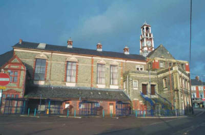
3.13. Listed and Other Historic Buildings3.13.1. Section 1 of the Planning (Listed Buildings & Conservation Areas) Act 1990 (as amended) requires the National Assembly for Wales (NAW) to compile lists of buildings of special architectural or historic interest for the guidance of local authorities. Such buildings are graded to show their relative importance, i.e. Grade I (of exceptional interest), Grade II* (of particular importance of more than special interest), and Grade II (of special interest which warrant every effort being made to preserve them). Cadw: Welsh Historic Monuments, which is the Executive Agency which discharges the NAW’s responsibilities for the built heritage in Wales, completed a resurvey of ‘Listed Buildings’ in the County Borough at the start of 1999. This up-to-date list contains 359 buildings in total, graded as shown in Table ENV3 (below):- TABLE ENV3
|
||||||||||||||||||||||||||||||||||||||||||||||||||||||||||||||||||||||||||||||||||||||||||||||||||||||||||||||||||||||||||||||||||||||||||||||||||||||||||||||||||||||||||||||||||||||||||||||||||||||||||||||||||||||||||||||||||||||||||||||||||||||||||||||||||||||||||||||||||||||||||||||||||||||||||||||||||||||||||||||||||||


| GRADE I | GRADE II* | GRADE II |
| 8 BUILDINGS | 35 BUILDINGS | 316 BUILDINGS |
3.13.2. The purpose of listing is to ensure that a building’s special architectural or historic interest is fully recognised, and that any works for its demolition, or for its alteration or extension (in any way) which would affect its character as a listed building, are brought within statutory control. Once listed, it is a criminal offence to carry out such works without consent, which should be sought from the Council. Similarly, Sections 67 & 73 of the 1990 Act requires the Council to publish a notice of any planning application for development which, in its opinion, affects the setting of a listed building, or the character or appearance of a conservation area; and that requirement must not be ‘interpreted narrowly’.
3.13.3. The Council considers that listed buildings and their settings play a significant role in the townscape and architectural heritage of the County Borough, and it therefore attaches considerable importance to their conservation.
3.13.4. Once a building is listed (or subject to a Building Preservation Notice), controls will apply to works, both internal as well as external, that would affect its special interest, and similarly apply whether or not the particular feature concerned is specifically mentioned in the description of the building on the list. Fixtures and curtilage buildings i.e. any object or structure which is fixed to the building, or which is within the curtilage and forms part of the land (and has done so since before 1 July 1948) are also treated as being part of the building for the purposes of planning control. Therefore, before making alterations to such a building which would materially affect its character or its setting, owners or developers are encouraged to seek early advice from the Council and/or Cadw prior to making an application for Listed Building Consent for the proposed works. It should be noted, however, that there is no statutory requirement to have regard to the provisions of the development plan when considering an application for Listed Building Consent (as Section 54A of the 1990 Act does not apply).
3.13.5. Policies in this Section of the Plan therefore emphasise the importance of the conservation of listed buildings and their settings, and provide planning policy guidance on other buildings of ‘local architectural or historic interest’.
3.13.6. DEMOLITION OF LISTED BUILDINGS
POLICY EV32
DEMOLITION OF A LISTED BUILDING WILL NOT BE PERMITTED UNLESS IT HAS BEEN CLEARLY
DEMONSTRATED THAT THE BUILDING IS WHOLLY BEYOND ECONOMIC REPAIR OR RE-USE FOR
ANY BENEFICIAL PURPOSE AND UNLESS AND UNTIL APPROPRIATE LEGAL AGREEMENT(S) HAVE
BEEN MADE WITH THE COUNCIL, AND IMPLEMENTED, TO SECURE THE PROPER SPECIALIST
RECORDING OF THE BUILDING AND ITS FEATURES AND ITS PROVISIONS IMPLEMENTED, PRIOR
TO ANY DEMOLITION WORKS TAKING PLACE.
![]()
3.13.7. Since the number of buildings of special architectural or historic interest is limited, there is a strong presumption in favour of their preservation except in exceptional circumstances, e.g. structural instability and consequent danger to the public. In such circumstances, the Council would consider permitting demolition of a listed building; and then, only after the agreement of the NAW through its executive agency Cadw: Welsh Historic Monuments, and subject to the provision of a full analysis of the building, its problems, potential for re-use, and relative costs. Potential developers must have demonstrated to the satisfaction of the Council and Cadw that:-
- All reasonable efforts have been made to sustain existing uses, or to find viable new uses for the building;
- Adequate attempts have been made to sell the building and its freehold on the open market; and
- It is neither possible nor feasible for the building to be preserved by either a charitable trust, or through some form of ‘community ownership’.
Where demolition of a listed building is proposed, the Council considers that proper specialist recording of the building and its features is essential. The Council will impose the relevant planning conditions on consents, and require developers to agree any necessary planning obligations/agreements in order to ensure that proper specialist recording is completed before any works to demolish the listed building are begun. It should also be noted that WO Circular 61/96 states that …..the RCAHMW must be notified of all proposals to demolish listed buildings and allowed access to buildings which it wishes to record before demolition takes place.
3.13.8. DEVELOPMENT AFFECTING LISTED BUILDINGS
POLICY EV33
DEVELOPMENT PROPOSALS WHICH WOULD EITHER HARM OR ADVERSELY AFFECT THE SPECIAL
ARCHITECTURAL OR HISTORIC INTEREST OF A LISTED BUILDING, AND/OR ITS SETTING,
WILL NOT BE PERMITTED. THOSE WORKS WHICH ALTER, BUT DO NOT ADVERSELY AFFECT, THE
CHARACTER OF THE BUILDING, AND/OR ITS SETTING, MUST BE DEMONSTRATED TO BE
DESIRABLE OR NECESSARY TO THE SATISFACTION OF THE COUNCIL/CADW IN ORDER TO BE
PERMISSIBLE, AND AN OPPORTUNITY AFFORDED, WHERE THIS IS REQUIRED, FOR THE PROPER
SPECIALIST RECORDING OF THE BUILDING AND ITS FEATURES PRIOR TO ANY WORKS BEING
COMMENCED, IN ACCORDANCE WITH THE RELEVANT CONSENT(S) SUBJECT OF THE NECESSARY
PLANNING CONDITIONS AND/OR PLANNING OBLIGATIONS/AGREEMENTS.
![]()
3.13.9. The architectural or historic features which contribute to the special interest of a Listed Building should be preserved. Therefore their alteration requires the greatest skill and care in order that damage to historic features is avoided, that any additions remain in keeping with the remainder of the building, and to ensure that any new external or internal features harmonise with their surroundings i.e. their settings. Small details, such as the mouldings of a door or window, can make very important contributions to an historic building’s character, and the inappropriate replacement or loss of such details can damage its appearance. Where an alteration to a listed building is proposed, the Council or Cadw may consider that proper specialist recording of the building and its features is required. The Council will impose the relevant planning conditions on consents, and require developers to agree any necessary planning obligations/agreements in order to ensure that proper specialist recording is completed before any works to alter the listed building are begun.
3.13.10. The setting of a listed building is often an essential feature of its character. It is important to consider the effect that proposed development may have on such settings, which may be limited to the immediate surroundings in the case of some buildings, but more often they may include land some distance from the listed building e.g. where the setting includes a building’s planned grounds/gardens etc., or where a listed building forms an important visual element in a street - development elsewhere in the street would have a material impact on the setting of the building. A proposed high building may also affect the setting of a listed building which may be some distance from it.
3.13.11. DEVELOPMENT AFFECTING BUILDINGS OF LOCAL SIGNIFICANCE
POLICY EV34
DEVELOPMENT WHICH ADVERSELY AFFECTS THE CHARACTER AND SETTING OF
BUILDINGS/STRUCTURES/SITES OF LOCAL ARCHITECTURAL OR HISTORIC INTEREST WILL NOT
BE PERMITTED.
![]()
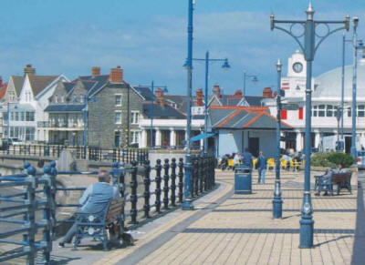
3.13.12. Whereas the best examples of local building types will normally be listed, many buildings which are valued for their contribution to the local scene, or for their local historical associations, have not merited listing to date. Such buildings will sometimes be protected by conservation area designations. A comprehensive inventory of buildings/structures/sites of local architectural or historic interest is currently being prepared and will form part of the proposed Built Heritage Strategy. The inventory will include details which justify their inclusion. This will provide future detailed Supplementary Planning Guidance (SPG) for the conservation of those buildings of local significance.
3.13.13. USE AND REPAIR OF HISTORIC BUILDINGS
POLICY EV35
SCHEMES WHICH MAINTAIN LISTED BUILDINGS AND BUILDINGS OF LOCAL ARCHITECTURAL OR
HISTORIC INTEREST IN OPTIMUM USE AND IN GOOD REPAIR WILL BE FAVOURED.
![]()
3.13.14. Listed buildings and buildings of local architectural or historic interest are a valuable and irreplaceable resource which benefit from being kept in good repair and in use. The optimum use of an historic building(s) is generally that for which it was originally constructed, and ideally the fabric and design of an historic building should remain in its original built form. However, changing circumstances may necessitate alterations or extensions, and where such proposals have satisfied Policies EV33 or EV34, these will be favoured where it can be demonstrated that they will assist in keeping the building in optimum use. The great majority of historic buildings are capable of beneficial use and, with skilled and understanding treatment, new development can usually be designed so as to blend in happily with the old. It may be justifiable to relax controls over land use allocation, density, plot ratio, day lighting, and building regulations, where this would enable an historic building or group to be given a new lease of life. This may apply particularly in the case of warehouses, churches, barns, etc., where the size and character of the building presents particular difficulties. Policy EV35 is intended to encourage developers and property owners to take a more robust approach to the future repair and/or use of listed buildings of local architectural or historic interest in the County Borough.
3.13.15. RE-USE OF REDUNDANT HISTORIC BUILDINGS
POLICY EV36
SCHEMES FOR THE SUITABLE REUSE OF REDUNDANT HISTORIC BUILDINGS OR VACANT FLOOR
SPACE WHICH CONTRIBUTE TO THE REGENERATION OF THE COUNTY BOROUGH WILL BE
FAVOURED.
3.13.16. There is a presumption in favour of the preservation, and conversion where necessary, of listed buildings and those buildings located within conservation areas; however, such consideration should also be given to other unprotected historic buildings of local and vernacular interest. It is accepted that occasionally old buildings may reach the end of their useful life even after their original use may have disappeared, and should make way for new development; however many have not yet reached that stage, and can with the exercise of a little imagination be creatively reused and thereby enhance the economic and social activity of an area. The same considerations may also apply to an historic building, part of which may be in beneficial use, but elsewhere may have vacant, or under-used floor space.
![]()
3.14. Conservation Areas
3.14.1. The Planning (Listed Buildings and Conservation Areas) Act 1990 (as amended) places a duty on local planning authorities to designate as a Conservation Area any:-
.....area of special architectural or historic interest the character or appearance of which it is desirable to preserve or enhance. (Section 69, of the 1990 Act refers).
3.14.2. Fifteen Conservation Areas have been designated in the County Borough to date. A full list of those Areas is contained in Table ENV4 together with the dates of their designation and any subsequent reviews (where applicable).
TABLE ENV4
CONSERVATION AREAS IN BRIDGEND COUNTY BOROUGH
| CONSERVATION AREA | COMMUNITY | DATE DESIGNATED | Link to Map |
| Bridgend Town Centre* | Bridgend | 23 June 1999 | 34 |
| Coity | Coity Higher | 17 August 1973 | 22 West |
| Derllwyn Road, Tondu | Ynysawdre | 16 July 1986 | 15 |
| Laleston | Laleston | 17 August 1973 | 26 East |
| Llangeinor | Ogmore Valley/Garw Valley | 7 March 1975 | 12 West |
| Llangynwyd | Llangynwyd Middle | 17 August 1973 | 10 Central |
| Maesteg Town Centre | Maesteg | 28 February 2001 | 33 |
| Merthyr Mawr Road, Bridgend | Bridgend | 14 October 1980 | 35 |
| Merthyr Mawr Village | Merthyr Mawr | 30 March 1973 | 31 West |
| Nantymoel | Ogmore Valley | 10 August 1973** | 7 Central |
| Newcastle Hill, Bridgend | Bridgend | 23 June 1999 | 27 Central |
| Newton, Porthcawl | Porthcawl | 31 August 1973 | 29 East |
| Nottage, Porthcawl | Porthcawl | 31 August 1973 | 25 Central |
| Porthcawl | Porthcawl | 31 August 1973 | 37 |
| Tythegston | Merthyr Mawr | 17 August 1973 | 26 Central |
* Incorporates former Court Road Conservation Area in Bridgend.
** Conservation Area formally amended 08/10/2003.
3.14.3. In addition to the fifteen designated Conservation Areas in the County Borough, the Council has identified four further areas for prospective appraisal for Conservation Area designation during the Plan Period i.e. at Blackmill, Glanrhyd Hospital in Penyfai, Penyfai (village), and at Preswylfa, Bridgend.
3.14.4. It is important that planning policies do not inhibit necessary adaptation and change in the designated and future Conservation Areas. It is also essential, however, that any future development does not destroy or devalue their character and appearance. For these reasons the Council, as part of its Built Heritage Strategy, will be preparing Management Plans for each of the designated Conservation Areas during the Plan Period of the UDP. Particular attention will be afforded to detailed design matters such as the traditional form of shopfronts. Therefore, in addition to the above, and the following Plan policies, the Council will continue to apply detailed design Guidance for Developments in Conservation Areas prepared as Supplementary Planning Guidance (SPG) by the former Ogwr BC.
3.14.5. DEVELOPMENT OUTSIDE BUT AFFECTING CONSERVATION AREAS
POLICY EV37
DEVELOPMENT ON LAND ADJACENT TO A CONSERVATION AREA WILL ONLY BE PERMITTED IF IT
WOULD PRESERVE OR ENHANCE THE SETTING OF THE CONSERVATION AREA, AND VIEWS IN AND
OUT OF IT.
![]()
3.14.6. DEVELOPMENT WITHIN CONSERVATION AREAS
POLICY EV38
PROPOSALS FOR DEVELOPMENT WITHIN CONSERVATION AREAS SHOULD PRESERVE OR ENHANCE
THEIR ARCHITECTURAL OR HISTORIC CHARACTER OR APPEARANCE. DEVELOPMENT PROPOSALS
WHICH DO NOT:-
1. PRESERVE OR ENHANCE VIEWS, VISTAS, CHARACTERISTIC STREET SCENES AND
ROOFSCAPES;
2. SHOW SPECIAL REGARD TO AREAS OF SPATIAL IMPORTANCE AND THEIR RELATIONSHIP TO
THE LAYOUT AND SCALE OF NEARBY BUILDINGS;
3. USE MATERIALS APPROPRIATE TO THEIR SETTING AND CONTEXT;
4. PAY SPECIAL REGARD TO PROTECT TREES, HEDGES AND OTHER HABITATS OF IMPORTANCE
TO BIODIVERSITY AND VISUAL AMENITY; AND
5. RESPECT LOCAL HISTORICAL AND CULTURAL TRADITIONS;
WILL NOT BE PERMITTED.
![]()
3.14.7. In the past, there has been a certain amount of unsympathetic development within, or adjacent to, what are now the designated Conservation Areas in the County Borough, which has had an adverse impact on those areas. The accumulation of buildings of mediocre design and visual quality has diluted the special identity for which those areas are valued. Previous development plan policies have addressed this issue, with resultant visual improvements to the amenity of the County Borough’s Conservation Areas. However, it is necessary to maintain this increased momentum to conserve the special character and appearance of those areas, especially now that there are even greater pressures for redevelopment within existing urban areas, especially on ‘brownfield’ sites. Future development proposals, which are situated either within designated Conservation Areas, or are located outside and adjacent to them, must preserve or enhance the architectural or historic character or appearance of the Conservation Area and/or enhance its setting, otherwise they will not be permitted under Policy EV38 and/or Policy EV37, respectively.
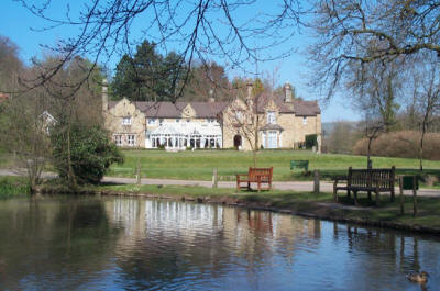
3.14.8. Developments must either strengthen the special character of the Conservation Areas, or at least maintain their existing qualities, e.g. the replacement of an eyesore with a building whose scale, form, materials and details reinforce local vernacular design, or a simple change of use (or domestic extension hidden from public view), respectively, would achieve those objectives and could therefore be acceptable. The Council will expect all applications for development in Conservation Areas to be submitted in a sufficiently detailed form in order that the necessary strict control can be exercised to preserve and enhance the special quality of those areas.
3.14.9. The Council may also utilise its powers under Article 4(2) of the Town and Country Planning (General Permitted Development) Order 1995 to withdraw specific permitted development rights for certain types of development (including partial demolition of buildings) in a conservation area if it considers this to be necessary to protect its special character or appearance. The Council reserves the option to consider whether new Article Directions would strengthen its duty to preserve and enhance the amenity of the conservation areas of the County Borough.
3.14.10. Such controlled change, however, can preferably be achieved by encouraging the adaptation and re-use of buildings which contribute positively to a Conservation Area. The economics of development are also important, and in some instances major problems, such as structural instability, may tip the balance in favour of redevelopment schemes. In such instances, the Council will seek to ensure that new buildings are visually compatible with their surroundings, preserve street patterns, building lines, and exclude inappropriate backland or ‘tandem’ developments. Areas of spatial importance in Conservation Areas include those areas, whether gardens or fields, car parks or village greens, whose undeveloped nature are significant elements of their character, and, as such will be protected by the Council.
3.14.11. Trees within Conservation Areas are already afforded protection, as anyone wishing to top, lop, or fell a tree must give the local planning authority six weeks written notice of their intentions. This gives the Council the opportunity to place a Tree Preservation Order on those trees which are of significance to local visual amenity.
3.14.12. DEMOLITION OF UNLISTED BUILDINGS IN CONSERVATION AREAS
POLICY EV39
DEVELOPMENT PROPOSALS INVOLVING THE DEMOLITION OF AN UNLISTED BUILDING WITHIN A
CONSERVATION AREA WHICH MEET ALL OF THE FOLLOWING CRITERIA:-
1. THE EXISTING BUILDING DOES NOT MAKE A POSITIVE CONTRIBUTION TO THE CHARACTER
OR APPEARANCE OF THE CONSERVATION AREA;
2. THERE IS DEMONSTRATED TO BE NEGLIGIBLE SCOPE FOR IMPROVEMENT, ADAPTATION, OR
CONVERSION OF THE BUILDING; AND
3. DETAILED PLANS FOR THE REDEVELOPMENT OF THE SITE, WHICH WOULD PRESERVE OR
ENHANCE THE CHARACTER OR APPEARANCE OF THE CONSERVATION AREA, ARE IN PLACE;
WILL BE PERMITTED. PROVIDED THAT SUBSEQUENT REDEVELOPMENT OF THE SITE IS ALSO IN
ACCORDANCE WITH A SITE DEVELOPMENT BRIEF OR OTHER APPROVED PLAN, PLANNING
CONSENTS (WHICH MAY BE SUBJECT OF CONDITIONS), AND ANY NECESSARY PLANNING
OBLIGATIONS/AGREEMENTS AS REQUIRED BY THE COUNCIL.
![]()
3.14.13. The House of Lords judgement in the case of Shimizu (UK) Ltd. v Westminster CC(1997) has resulted in a redefinition of demolition of an unlisted building in a conservation area which must now comprise the ‘total or substantial destruction of the building concerned’. This means that many works which involve the destruction of the fabric, or part only, of a building will not constitute ‘works of demolition’ and, therefore, will not require Conservation Area Consent. Consent for the ‘demolition’ of unlisted buildings in Conservation Areas will not be granted by the Council in the absence of detailed and acceptable proposals for their replacement. Such a consent will therefore be appropriately conditioned in order to ensure that any ‘demolition’ works (as defined) are directly linked to the phased implementation of a scheme detailed in a ‘site development brief’, and comply with any relevant Planning Obligations and Agreements concluded with the Council.
3.14.14. HIGHWAYS IN CONSERVATION AREAS
POLICY EV40
HIGHWAY WORKS IN CONSERVATION AREAS WILL BE PERMITTED WHERE THEY WOULD PRESERVE
OR ENHANCE THE CHARACTER OR APPEARANCE OF THOSE AREAS.
![]()
3.14.15. Some of the most destructive past developments which have adversely affected the Conservation Areas in the County Borough have arisen through unsympathetic improvements to the highway network. The widening and straightening of roads through villages has not necessarily improved safety for residents, rather it has favoured increased speed and movement of traffic to the detriment of more sustainable means of transportation. Further, when done on a piecemeal basis, a village can be visually blighted for decades with pieces of pavement leading nowhere, and new housing being set back from established building lines at the expense of retaining traditional and local street scenes. The Council and its predecessors have sought to reverse these retrograde policies and will generally oppose developments which involve the widening of roads in Conservation Areas or, in their stead, the unnecessary loss of farmland for new road infrastructure such as by-passes. However, it will support traffic management measures which reduce and/or calm traffic in Conservation Areas, and promote more sustainable modes of transport. Other works such as re-paving following pedestrianisation, bus lane markings, new signage, and new street furniture should be designed in a manner which do not adversely affect the Conservation Area’s character and appearance.
3.14.16. THE ‘PUBLIC REALM’ WITHIN CONSERVATION AREAS
POLICY EV41
IMPROVEMENT SCHEMES WITHIN THE PUBLIC REALM OF A CONSERVATION AREA WHICH ENHANCE
ITS CHARACTER OR APPEARANCE WILL BE FAVOURED; WHEREAS, THOSE WHICH ADVERSELY
AFFECT ITS CHARACTER OR APPEARANCE WILL NOT BE FAVOURED.
3.14.17. The character and appearance of Conservation Areas derives not only from its buildings but also from the spaces between them. Much of these comprise the ‘Public Realm’ of street, pavement, public square, green space, park, and open water, and this is largely in public ownership. Public Bodies are therefore in a position to implement schemes within a Conservation Area which could enhance its special character or appearance, but which, conversely, could be undertaken without due regard to the adverse effects they may have. Policy EV41 aims to actively promote positive enhancements to the ‘Public Realm’ within the Conservation Areas of the County Borough. As such, it will act as a corollary to Policies EV37 – EV40.
![]()
3.15. Historic Parks, Gardens and Landscapes
3.15.1. Cadw: Welsh Historic Monuments, in association with ICOMOS (the International Council on Monuments and Sites), the CCW (Countryside Council for Wales), Welsh local authorities, the National Trust, Hyder plc, the Welsh Historic Gardens Trust, the RCAHMW (Royal Commission on Ancient and Historical Monuments of Wales) et al, have published a Register of Landscapes, Parks and Gardens of Special Historic Interest in Wales. The Register comprises two parts: Part 1 addresses historic parks and gardens of Wales, from those in towns and cities, which became so important as urban populations swelled in the nineteenth century, to those of the rural estate which, so often as to be almost characteristic, borrowed the scenery of Wales to create an aesthetically satisfying sense of place; Part 2 addresses the historic landscapes of Wales.
3.15.2. The Register entails no additional planning controls, but statutory consultation is to be introduced on planning applications affecting sites on Part 1 of the Register. The relative mechanism to be put in place is set out in the General Development Order Consolidation 1995, and in WO Circulars 29/95, 61/96 and 1/98. Also, Welsh Planning Guidance advises (inter-alia) that local planning authorities should take each part of the Register into account when preparing their UDPs. Therefore:-
3.15.3. HISTORIC LANDSCAPES, PARKS AND GARDENS
POLICY EV42
(A) DEVELOPMENT WHICH WOULD ADVERSELY AFFECT AN HISTORIC PARK OR GARDEN, OR
THEIR SETTINGS, WILL NOT BE PERMITTED.
(B) DEVELOPMENT WHICH WOULD ADVERSELY AFFECT AN HISTORIC LANDSCAPE WILL NOT BE
PERMITTED.
![]()
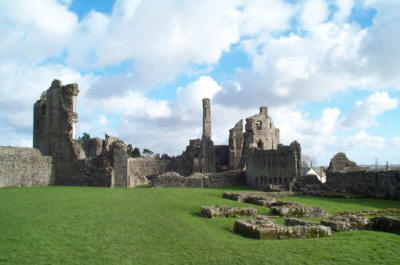
3.15.4. Landscapes such as parkland and gardens, mediaeval field systems and industrial landscapes, are important components of the historic environment, whose special quality and character needs to be conserved. Part 1 of the Cadw/CCW/ICOMOS Register identifies Merthyr Mawr House as being a Grade II* Historic Park and Garden, and the following 4 further sites as Grade II Historic Parks and Gardens, in the County Borough:-
- Bryngarw
- Court Colman
- Glanrhyd Hospital; and
- Tythegston
3.15.5. The above entries are accompanied in the Register by plans which distinguish between their respective park boundaries, gardens, kitchen gardens, pleasure grounds (in some instances), significant views, and their essential settings. All of these factors will be taken into account by the Council in applying Policy EV42(A) to any relevant development proposals affecting those historic parks and gardens.
3.15.6. Whereas the scenic and wildlife components of the landscape of the County Borough have already been addressed in earlier Sections of this Chapter, and have been recognised and appreciated for some time, the historic component (which often lies at the heart of its creation) has rarely been given the same recognition in the past. Part 2 of the Cadw/CCW/ICOMOS Register, and the Council, by implementing Policy EV42(B) of the UDP, seek to redress these concerns.
3.15.7. Part 2.1 of the Register of Landscapes of Historic Interest in Wales includes two areas of the County Borough in a single ‘Outstanding Historic Landscape’, notably:-
- The Merthyr Mawr, Kenfig and Margam Burrows.
3.15.8. Each area is characterised by accumulations of wind blown sand and form considerable features of littoral dunes adjacent to the coastline of the County Borough. Merthyr Mawr Warren has a generally ancient landscape with archaeological sites which have been buried by sand. Kenfig also has a be-sanded landscape that derives from adverse weather conditions and tidal phenomena in the Middle Ages and perhaps earlier. The ‘setting’ of the Merthyr Mawr and Kenfig ‘Outstanding Historic Landscape’ is coterminal with the Coastal Zone as identified for Policy EV15 (earlier) - which is shown on the Proposals Map.
3.15.9. Part 2.2 of the Register of Landscapes of Historic Interest in Wales includes the following area as a landscape of ‘Special Historic Interest’:-
- Margam Mountain
A substantial part of this landscape area extends eastward from the adjacent Neath Port Talbot County Borough into Bridgend County Borough.
3.15.10. Margam Mountain is a discrete block of the South Wales uplands situated at the south west fringe of the historical ‘Glamorgan Blaenau’, which displays continuity, density, and diversity of human occupation from the prehistoric period to the recent past. The area includes Bronze Age monuments, large Iron Age hillforts, settlements, enclosures (including ‘Y Bwlwarcau’ near Llangynwyd), and trackways, a Roman Road, an important group of Early Christian monuments etc. mediaeval defensive works, and other later features of historic importance up until WWII. The general extent of this Landscape of ‘Special Historic Interest’ within the County Borough is also shown on the Proposals Map.
![]()
3.16. Archaeology
3.16.1. Archaeological remains are a finite and non-renewable resource, and in most cases they are also fragile and vulnerable to erosion, damage and destruction. As the product of human activity in the County Borough since pre-historic times, these remains are now in varying states of condition and completeness. Some remains are small and barely visible in the modern landscape e.g. an eroded Bronze Age tumulus or burial mound, a rampart to an Iron Age hill fort or a mediaeval field pattern; whereas others may be more substantial and well preserved e.g. Coity Castle, the Old Bridge at Bridgend, and the Bedford Iron Works (near Cefn Cribbwr).
3.16.2. Many archaeological remains have been destroyed by human activities, for example, by modern construction methods in urban development and expansion of the road network, by changing agricultural practices, or by mineral extraction and waste tipping. Appropriate management of this resource is therefore essential to ensure that archaeological remains are not destroyed and survive, for the enjoyment and education of future generations, and as a part of our cultural heritage which can be enjoyed by residents and visitors alike.
3.16.3. It is a duty of the National Assembly for Wales (NAW) to compile and maintain a schedule of Ancient Monuments of national importance under the Ancient Monuments and Archaeological Areas Act 1979. Cadw: Welsh Historic Monuments is responsible for advising on which monuments should be considered for scheduling, and on whether any should be de-scheduled, or amended in the lists. Occupied dwellings and churches in use for ecclesiastical purposes cannot be scheduled, but monuments on Crown Land can be, but remain subject of a non-statutory procedure known as Scheduled Monument Clearance with respect to development or other works affecting them.
3.16.4. There are currently 55 Scheduled Ancient Monuments in the County Borough (as at January 2001), as notified by Cadw. However, the County Borough’s known archaeological resource includes a far higher number of unscheduled sites. The Glamorgan-Gwent Archaeological Trust Ltd. has previously confirmed to the Council that not all of the sites which fulfil the criterion of national importance have yet been identified, and there are undoubtedly unscheduled sites which are worthy of statutory protection.
3.16.5. To implement the above, and the Policies which follow, the Council will rely heavily on the information provided by Cadw, further information contained in the County Sites and Monuments Record maintained by the Glamorgan Gwent Archaeological Trust Ltd., and a Report prepared by Mr Philip Ridden in March 1992 for the former Ogwr BC entitled The Industrial Heritage of Ogwr (to assist the former Authority in the formulation of a conservation and interpretation policy for the industrial heritage of its district, and which continues to provide valuable ‘guidance' to the Council). The LANDMAP survey currently being undertaken by the Council will also provide additional information about the County Borough’s archaeological resource. Individual artefacts, if properly recorded, can similarly provide evidence of movements of past communities of people, and valuable insights into ancient development, and past traditional or local cultures.
3.16.6. All ancient monuments are material considerations in the planning process. The Council considers the archaeological resource of the County Borough to be considerable and varied, and should therefore be managed appropriately, and in the interests of sustainable development. The following Policies are designed to ensure that ancient monuments and their settings and archaeologically sensitive areas are protected from inappropriate development, and to ensure that necessary investigations and/or recording of sites and artefacts are carried out prior to, during, and after development has taken place if it is permitted.
3.16.7. DEVELOPMENT AND ARCHAEOLOGY
POLICY EV43
WHERE DEVELOPMENT AND/OR ANY OPERATION IS LIKELY TO AFFECT A KNOWN, POTENTIAL,
OR SUSPECTED SITE OF ARCHAEOLOGICAL SIGNIFICANCE, AN APPROVED ARCHAEOLOGICAL
EVALUATION SHALL BE SUBMITTED TO THE LOCAL PLANNING AUTHORITY BEFORE THE
PROPOSAL IS DETERMINED, SO THAT THE EFFECT OF THE PROPOSAL ON THE ARCHAEOLOGICAL
RESOURCE CAN PROPERLY BE DETERMINED.
![]()
3.16.8. If a development is likely to affect a known archaeological site or a site where there is good reason to suppose that archaeological remains will be affected, the Council will request a developer to arrange for a professional and approved archaeological field evaluation to be carried out prior to a decision being made on the application(s). The Council will expect detailed plans to pay due regard to the findings of those evaluations and/or their results.
3.16.9. DEVELOPMENT AND SITES OF ARCHAEOLOGICAL SIGNIFICANCE
POLICY EV44
DEVELOPMENT AND/OR ANY OPERATION WHICH FAILS TO PROTECT, ENHANCE, OR PRESERVE A
SITE OF ARCHAEOLOGICAL SIGNIFICANCE WILL NOT BE PERMITTED. WHERE AN
ARCHAEOLOGICAL ASSESSMENT HAS BEEN CARRIED OUT AND SUBMITTED TO THE COUNCIL IN
ACCORDANCE WITH POLICY EV43, WHICH INDICATES THAT A SITE OF ARCHAEOLOGICAL
SIGNIFICANCE WOULD BE AT RISK, DEVELOPMENT WILL NOT BE PERMITTED UNLESS:-
1. THERE IS NO ALTERNATIVE AVAILABLE SITE FOR THE DEVELOPMENT/OPERATION; AND
2. IN RESPECT OF NATIONALLY IMPORTANT ANCIENT MONUMENTS, WHETHER SCHEDULED OR
NOT, AND THEIR SETTINGS, THE DEVELOPMENT WOULD BE IN THE NATIONAL INTEREST;
3. FOR MOST ARCHAEOLOGICAL SITES, MITIGATION MEASURES CAN BE PUT IN PLACE WHICH
WOULD PRESERVE, PROTECT, OR ENHANCE THE ARCHAEOLOGICAL REMAINS AND THEIR SETTING
‘IN SITU’;
4. WHERE ARCHAEOLOGICAL REMAINS OF LESSER IMPORTANCE ARE INVOLVED, OR THEIR
SIGNIFICANCE IS OUTWEIGHED BY ALL OTHER MATERIAL CONSIDERATIONS, MEASURES TO
SECURE THE EXCAVATION AND/OR RESCUE AND RECORDING OF THE REMAINS, AND
PUBLICATION OF THE RESULTS CAN BE PUT IN PLACE.
WHERE APPROPRIATE, DEVELOPERS MAY BE REQUIRED TO ACCOMMODATE A WATCHING BRIEF BY
AN ARCHAEOLOGIST, OR ARCHAEOLOGICAL ORGANISATION, PRIOR TO, DURING, AND/OR AFTER
DEVELOPMENT OPERATIONS BY MEANS OF RELEVANT PLANNING OBLIGATIONS/ AGREEMENTS, AS
AGREED WITH THE COUNCIL, AND/OR BY CONDITIONS ATTACHED TO PLANNING CONSENTS.
![]()
3.16.10. . In order to protect, enhance, and preserve ancient monuments, and their settings, it is essential that development proposals recognise their importance. Policy EV44 aims to reconcile any need for development with the presumption in favour of the physical preservation of ancient monuments and their settings. Development and any other operations which adversely affect such sites will not be permitted if an alternative approach exists. If the site is nationally important, the proposal will be permitted by the Council only where it has additionally been clearly demonstrated that the development is necessary in the national interest. Where nationally important archaeological remains, whether scheduled or not, and their settings, are affected by proposed development, there shall be a presumption in favour of their physical preservation. National planning guidance stipulates that only some 4% of the recorded archaeological resource in Wales currently enjoys special protection as being ‘Scheduled Ancient Monuments’, (WO Circular 60/96 ‘Planning and the Historic Environment: Archaeology’ refers). However, Cadw is engaged upon a survey programme which is expected to result in significant additions to this category of site. Although not all ancient monuments are nationally important, all archaeological remains represent a finite and irreplaceable resource. Consequently the desirability of preserving any ancient monument and/or its setting is a material consideration in determining a planning application. Therefore where the Local Planning Authority is aware of a real and specific threat to a known archaeological site it will exercise the powers available to it under Article 4 of the Town and Country Planning (General Permitted Development) Order 1995 to remove any permitted development rights and ensure that planning permission is obtained before development may proceed. It is acknowledged that in some instances development may be allowed to proceed although it may adversely affect an ancient monument and/or its setting.
3.16.11. In most cases it is advisable, and indeed good practice, where a proposed development may affect a ‘Scheduled Ancient Monument’ and/or its setting, or an archaeologically sensitive area, that any necessary Scheduled Monument Consent is obtained prior to, or concurrent with, the submission of a planning application for that development. Ancient monuments should not be destroyed but should be preserved, either by being sensitively integrated into a new scheme to become part of the fabric of the area, or by being subject to excavation and preservation, in-situ if necessary, or by record or rescue. In certain circumstances, where the archaeological interest of a site cannot be adequately protected by alterations to the planned development, and thereby conditioned on the future planning consent, the Council may require that the developer and landowners enter into appropriate Planning Obligations/ Agreements with the Local Planning Authority under the terms of the British Archaeologists & Developers Liaison Group (BADLG) Code of Conduct, to allow for an archaeological investigation to be carried out prior to the development of the site.
3.16.12. Planning conditions may also define the requirement for an ‘archaeological recording’ of a site to be carried out within a specified period of time in advance of development works, or they may require that a ‘watching brief’ is maintained by approved/qualified archaeologists prior to or throughout construction phases, or, more rarely during a requisite post-construction period, in respect of a development. Where fresh archaeological discoveries are made during development, and are deemed by the Welsh Assembly Government to be of national importance in accordance with published criteria, they have the power to schedule those remains. Scheduled Monument Consent would then be required prior to any works continuing on that site. The Local Planning Authority or the Assembly Government may also revoke a planning consent if deemed necessary. In the majority of cases, however, it is usually possible for the parties to resolve emerging issues through voluntary discussion, and for mutually acceptable arrangements to be concluded for site development.
![]()
3.17. Design and the Built Environment
3.17.1. The aim of good design should apply to all proposals which affect the built or natural environment including construction or alteration of individual buildings, and groups of buildings, together with their settings, and larger, more comprehensive development proposals. The appearance of new development, its scale, and relationship to its surroundings are material planning considerations, therefore the following Policies indicate the Council’s general design expectations for all new development. Developers should also have regard to the Council’s published ‘Design Guides’ which constitute Supplementary Planning Guidance (SPG) to this UDP, namely:-
- Houses and Domestic Scale Buildings;
- House Extensions;
- Shop Fronts;
- The Conversion of Redundant Farm Buildings;
- Play and Amenity Open Space within Residential Areas;
- Conservation Areas; and
- Trees and Development.
3.17.2. The above were prepared by the former Ogwr BC but have been revised and updated by the Council. In addition, the Council currently operates the detailed SPG contained in the following document published by the former Mid Glamorgan CC:-
- Design Guide for Residential and Industrial Estate Roads.

3.17.3. The major changes in national planning and transport policies which aim to reduce the growth in car travel by encouraging the use of alternative forms of transport are reflected in a Revised Draft Parking Policy and Standards document published by the South Wales Consortium of Local Authorities (SWCOLA) in 1998. This document, when approved, will replace earlier Standing Conference Guidelines on Parking approved in 1993, and should therefore now be treated as the up-to-date SPG regarding this important aspect of the design and layout of new development in the County Borough.
3.17.4. NEW DEVELOPMENT DESIGN
POLICY EV45
NEW DEVELOPMENT WHICH ACHIEVES A GOOD STANDARD OF DESIGN BY:
1. HAVING A CONSISTENT STYLE OR CHARACTER;
2. RESPECTING THE CONTEXT OF THE DEVELOPMENT;
3. BEING APPROPRIATE TO THE SCALE AND PROMINENCE OF THE DEVELOPMENT;
4. INCORPORATING THOSE EXISTING FEATURES OF THE SITE THAT ARE IMPORTANT TO THE
LOCAL ENVIRONMENT, INCLUDING ITS TOPOGRAPHY, BIODIVERSITY, AND STRUCTURES OF
HISTORIC INTEREST;
5. USING SITING, LAYOUT, FORM, MATERIALS, AND ARCHITECTURAL DETAIL, AND PUBLIC
ART, TO CREATE A NEW, OR ENHANCE AN EXISTING, SENSE OF PLACE;
6. REASONABLY PROTECTING THE RESIDENTIAL AMENITY OF NEIGHBOURS, INCLUDING
PRIVACY, A QUIET ENVIRONMENT, DAYLIGHTING AND SUNLIGHTING;
7. BEING COMPATIBLE WITH THE ADEQUATE PROVISION OF AMENITIES (INCLUDING OPEN
SPACE) FOR RESIDENTS OR USERS OF THE DEVELOPMENT;
8. BEING COMPATIBLE WITH THE CREATION OF AN ENVIRONMENT WHICH IS SAFE, FRIENDLY
TO THE DISABLED, SUSTAINABLY ACCESSIBLE, MANAGEABLE, AND POLLUTION-FREE;
9. BEING COMPATIBLE WITH THE USE OF SUSTAINABLE METHODS OF CONSTRUCTION,
MATERIALS, ENERGY CONSERVATION, AND WATER MANAGEMENT;
WILL BE PERMITTED.
![]()
3.17.5. The Local Planning Authority will expect a high standard of architectural and urban design in new development. Policy EV45 sets out criteria for the assessment of design quality. The following notes briefly expand on those criteria. More advice regarding design can be found in the Council’s Design Guide series.
3.17.6. Consistency of style or character is regarded as a contributor to a sense of place. It is particularly relevant to housing developments, where there has been an unfortunate tendency to mix styles, materials, and forms arbitrarily. It is not the same as monotony of design, or the repetition of identical units; rather, it is the establishment of the interest of variation within a unifying harmony.
3.17.7. To strengthen the regional identity of the County Borough, ‘period’ style design should relate closely to the local architectural vernacular. Innovative, contemporary design should respect the colour and texture of local materials (mainly stone, render, and slate) or of the local landscape. Generally, new structures should harmonise with the scale and texture of adjacent buildings, although greater latitude may be extended to landmark or incident buildings (see below).
3.17.8. The nature of the design should reflect the scale and prominence of the development. An individual building may be a landmark, an incident, or a context building as part of the street scene. In developments of many buildings, the identification of landmark, incident, and context buildings is a stage in the creation of good urban design. Generally, context buildings will be harmonious, unassertive, and good mannered. Incident buildings will provide small scale interest, visual punctuation marks that relieve monotony, and create identity. While respecting the prevailing character, they will have variations of detail that attract attention. Landmark buildings may be such because of their scale, their location at focal points of views, or their function. These buildings have the greatest opportunity for innovation, but demand the highest quality of imagination so that their appearance rewards the attention forced upon them by being landmarks. Landmark buildings should also be appropriately located with regard to the wider urban design of their context.
3.17.9. Good design works with the existing attributes of a site, utilising existing slopes, streams, hedgerows, and trees to enhance the landscape of new development. The re-use of existing structures, where possible, is more sustainable than site clearance. Where those structures have architectural or historic merit, the resulting development is likely to benefit in terms of character and interest.
3.17.10. The Council seeks good design because it wants development to create or preserve a sense of place. The individual identity of the County Borough, its towns and villages is regarded as a key component of quality of life.
3.17.11. To enhance an existing or foster the creation of a new sense of place the Council will, where appropriate, encourage the incorporation of art work into the design of new development. A stimulating environment can lift the public’s morale, generate pride, and can discourage abuse of the environment. Public art can humanise public spaces and can encourage communities to reclaim their social spaces, especially where they have been involved in the design or selection process.
3.17.12. The Council will encourage developers to allocate a percentage of the capital costs of a new building, refurbishment or extension to enhance the design of the building and its context, as part of a “Percent for Art” scheme. In certain circumstances it may be appropriate for temporary artwork to be provided during construction as well as permanent artwork when the development is completed.
3.17.13. Where development takes place adjacent to housing, consideration must be given to the residential amenity of the adjoining homeowners. While some adverse change to the setting of existing housing may be the inevitable consequence of new development, that change must be minimised. At no time should it unreasonably affect the quality of life of neighbours.
3.17.14. Where new housing related development is proposed, its design must be compatible with the enjoyment of reasonable residential amenity by the householders. New housing development will also be expected to make adequate open space and recreation provision for its residents.
3.17.15. The design of development proposals should take account of the need for safety and convenience of the users of the development, including, especially, the disabled. Provision should be made, where relevant, for access by public transport, cycling, and walking.
3.17.16. A development proposal should aim to reduce the incidence or fear of crime. Consideration needs to be given to the layout of new housing, the qualities of lighting and landscaping, the location of seating and amenities in shopping areas, and the number and positions of entrances and exits to developments.
3.17.17. Good design will include measures to minimise and deal with any pollution arising from a development. One aspect of this is the reduction of pollution embodied in its construction and use. There are developing techniques of sustainable building and energy minimisation that can have substantial effects on design. The Council will generally welcome imaginative and innovative forms of development that seek to minimise impact on scarce resources.
3.17.18. Because of the importance it assigns to good design, the Local Planning
Authority requires that any application for planning permission for built
development be accompanied by a design statement. The design statement should
demonstrate how the applicant has taken account of the need for good design in
their development proposals and that regard has been paid to relevant
development plan policies and any supplementary planning guidance relating to
design. This should be done in a manner appropriate to the nature and scale of
the proposals.
3.17.19. The design statement should, as a minimum, include a short written
statement setting out the design principles adopted as well as illustrative
material in plan and elevation. This material should show the wider context, not
just the development site and immediately adjacent buildings. For
straightforward or small-scale development proposals this might simply comprise
photographs of the development site and its surroundings, drawings of the
proposed design itself and, where appropriate, plans of the proposed layout in
relation to neighbouring development uses. For complex or large-scale
development proposals, landmark buildings, and development involving sensitive
sites, it is likely that the inclusion of relevant perspective views will also
be appropriate.
3.17.20. The Crime and Disorder Act 1998 places new obligations on local authorities, the police, police authorities, health authorities and probation committees (amongst others) to work in partnership on the development and implementation of a Strategy for tackling crime and disorder in their area. Prior to the production of the Strategy the Council produced a Crime and Disorder Audit, which it published for public consultation in March 1999. The Council’s initial Strategy was therefore in place by August 1999. Crime prevention can be a material consideration when planning applications are considered by the local planning authority, as local authorities are under an obligation to consider the need to prevent crime ‘in all decisions which they take’.
3.17.21. CRIME PREVENTION
POLICY EV46
DESIGN MEASURES WHICH AIM TO REDUCE THE INCIDENCE, OR FEAR OF CRIME WILL BE
FAVOURED.
3.17.22. Policy EV46 recognises the need to enhance the designated use of spaces, especially in urban areas, in such a way to prevent the incidence and fear of crime. The layout of new housing developments, the arrangements for seating and enjoyment of amenities in town and district shopping centres, or the number and positions of entrances and exits to developments, for example, can improve the security of an area and improve the public’s perception or fear of crime in that area. The South Wales Constabulary similarly encourages developers to adopt guidelines to upgrade security against crime, and to promote fire safety, through its ‘Secured by Design’ scheme. The latter scheme encompasses estate design and layouts of proposed development, as well as matters which are outside the scope of planning control.
3.17.23. Whilst the Council generally supports all measures to reduce crime, it must always balance the security needs of applicants against other environmental, visual, and amenity concerns when it considers planning applications, especially in areas where it exercises special measures of control e.g. in Conservation Areas, or when it considers proposals affecting Listed Buildings, and/or their settings.
![]()
3.18. Access by the Disabled and others with Special Needs
3.18.1. The development of land and buildings provides the opportunity to secure a more accessible environment for everyone, including wheelchair users and other people with disabilities, elderly people, and people with young children.
3.18.2. The general aim should therefore be a ‘barrier-free environment’ for all. This can more readily be achieved by supporting the concept of ‘seamless travel’, and by considering the issues of access to the disadvantaged and less mobile groups in our society at an early stage in the design process for new development or redevelopment.
3.18.3. ACCESSIBILITY
POLICY EV47
PROPOSALS FOR DEVELOPMENT WHICH ARE EXPECTED TO BE USED OR VISITED BY THE
GENERAL PUBLIC SHALL MAKE PROVISION FOR PEOPLE WITH SPECIAL ACCESS NEEDS, e.g.
THOSE WITH DISABILITIES, PEOPLE WITH YOUNG CHILDREN, AND THE ELDERLY.
![]()
3.18.4. The need for accessibility is implicit in every activity in the built environment, e.g. the appropriate design of spaces between and around buildings, and the location and extent of parking provision, are particularly important to ensure good access to those buildings. Whether in the case of new developments, or in those instances where buildings are proposed to be extended or altered, developers should consider the need to provide access for all those who might use the building.
3.18.5. In the case of planning applications for new development where there is a conspicuous lack of provision for the less mobile (including the disabled), the Council will seek to resolve that issue in the first instance through negotiation with the prospective developer(s). If, however, there is a clear planning need for such provision, the Council will impose appropriate conditions on any forthcoming planning consents for development to ensure that there is adequate access for disabled people, and those with special needs.
3.18.6. Where the public have access to a building, the local planning authority will consider the extent to which provision for the disabled can be justified on planning grounds. In this respect, the Council has a duty, when granting planning permission for new, or the alteration etc. of existing buildings, to draw applicants’ attention to their statutory obligations under the Chronically Sick and Disabled Persons Act 1970 and the Disability Discrimination Act 1995. The internal layout of buildings (with the exception of certain Listed Buildings) is not usually a material planning consideration. Part M of Schedule 1 to the Building Regulations 1991 imposes requirements on how non-domestic buildings should be designed and constructed to meet statutory needs for people with disabilities. It is not therefore appropriate for the UDP to deal with such matters, however, in dealing with proposals affecting listed buildings and/or their settings, and other local buildings of architectural or historic significance, the Council will explore with applicants those alternative measures (to altering the characteristic features of such buildings) which may be taken to achieve suitable access provision for the disabled and those with special mobility needs.
3.18.7. Part M of the Building Regulations therefore requires that all new residential developments shall be built to visitability standards suitable for those with disabilities, or their use by the elderly or those with young children. For instance, this includes gradual gradients to dwellings, level thresholds, wider circulation spaces and toilets at ground floor level and allowance for stair lifts etc. to higher levels. New shopping development, including changes of use, must similarly be planned with such issues in mind, whereas existing shops should be adapted whenever possible to serve the special needs of the less mobile. Similarly, adequate parking should be provided in new shopping and commercial developments to serve their needs. However, where this is not possible, ‘Mobility Schemes’ may offer suitable alternative access provision in, for example, existing town centres.
3.18.8. The Planning Officer’s Society for Wales (POSW) has recently prepared a compendium of model good practice entitled Access For All - (Creating a Barrier Free Environment), which the Council will be recommended to approve as SPG to Policy EV47 during the Plan Period.
![]()
3.19. Control of Outdoor Advertisements
3.19.1. Virtually all outdoor advertisements are subject to the control of the local planning authority, in the interests of amenity, and/or public safety. However some types of advertisement are exempted from detailed control, and other specified categories of advertisement qualify for deemed consent, provided they conform to certain stated conditions and limitations.
3.19.2. OUTDOOR ADVERTISEMENT CONTROL
POLICY EV48
OUTDOOR ADVERTISEMENTS WHICH WOULD DETRACT FROM VISUAL AMENITY OR ENDANGER
PUBLIC SAFETY WILL NOT BE PERMITTED. PROPOSALS WHICH:-
1. RELATE CAREFULLY TO THE CHARACTER, SCALE AND ARCHITECTURAL FEATURES OF THE
BUILDING ON WHICH THEY ARE PROPOSED TO BE PLACED;
2. AVOID CREATING A ‘CLUTTER’ OF ADVERTISEMENTS BY VIRTUE OF THEIR CUMULATIVE
IMPACT;
3. IF ILLUMINATED, SATISFY THE REQUIREMENTS OF
POLICY EV29 AND THEREFORE LEAD TO
AN OVERALL REDUCTION, RATHER THAN AN INCREASE, IN NIGHT TIME LIGHT POLLUTION;
4. BE SITED AND DESIGNED WHERE THEY WILL NOT DISTRACT USERS OF HIGHWAYS,
CYCLEWAYS OR FOOTPATHS;
5. ENSURE THE CONTINUED SAFE AND EASY PASSAGE OF PEDESTRIANS, AND ESPECIALLY NOT
HINDER THE MOVEMENT OF THE DISABLED, THE ELDERLY, AND PEOPLE WITH YOUNG
CHILDREN; AND
6. IN ALL OTHER RESPECTS, CONFORM WITH ACCEPTABLE AMENITY AND SAFETY STANDARDS;
WILL BE PERMITTED.
![]()
3.19.3. Policy EV48 seeks to control outdoor advertisements in areas, or parts of areas, where the display of poorly designed advertisements will be especially harmful and consequently be of material importance to planning decisions. However it should be stressed that the Council always assesses the specific amenity and public safety merits of a proposed advertisement display in relation to its particular proposed site.
3.19.4. The Council will exercise strict planning control over advertisements, including those displayed on business premises, poster displays, flag advertisements, bus shelter advertisements and free-standing displays. Advertisements and signs should be designed and sited to harmonise with their settings, particularly those in the countryside - where a proliferation of advertisements guiding visitors to individual businesses etc. would be visually intrusive and unacceptable. Businesses are encouraged in all instances to combine their essential advertising needs and to share common signage, and to heed other Government Guidance to advertisers. The natural and built environment also needs protection from the eyesore of obtrusive advertisements, especially in those areas of high landscape quality e.g. the largely undeveloped Glamorgan Heritage Coast, the Merthyr Mawr and Kenfig Historic Landscape and within the settings of Historic Parks and Gardens; and in Conservation Areas.
3.19.5. Advertisements may not jeopardise public safety, as the Council must have regard to the safety considerations of all transport modes and their users. This consideration equally applies to pedestrians, cyclists and drivers. Excessive luminance from advertisements can cause traffic and pedestrian hazards as they have the potential to distract passers by, with road safety implications. Also it is desirable to restrict the proliferation of illuminated advertisements, in order to mitigate light pollution at night.
3.19.6. Signs which are affixed to business premises raise additional issues as they greatly contribute to the overall appearance of the street scene. They need to be in keeping with the street frontage and to retain the character of traditional frontages, whether this is conspicuous as on the prime frontage for example, or indeed if placed on important reversed or side frontages especially at street junctions and pedestrian side turnings in shopping streets. Where advertisements/signs are proposed to be mounted on business premises in designated Conservation Areas further restrictions or special requirements may be expected to be applied to them by the local planning authority, although such designations may not necessarily justify them also being defined as Areas of Special Control of Advertisements.
3.19.7. Almost all advertisements on listed buildings or scheduled ancient monuments will be considered an alteration to the building or monument, and will therefore require either Listed Building, or Scheduled Monument Consent - as appropriate, in addition to any advertisement consent. Special care should be exercised to ensure that any advertisement/sign displayed on, or close to, a listed building or scheduled ancient monument, does not detract from the integrity of the building’s design, historical character or structure, and does not spoil or compromise their settings.
3.19.8. The County Borough has an attractive coastline and countryside which attract many visitors each year, and Porthcawl is a popular tourist resort. Similarly, it has been an attractive area for developers to build new housing estates, each of which from time to time generate unwarranted/excessive advertisements. Whilst the ‘need’ to advertise certain destinations to visitors and/or construction traffic is acknowledged in the interests of commercial enterprise and information, the majority of these directional advertisements cause an unacceptable ‘clutter’ along highways. Serious amenity problems would result if they were to be left to accumulate in an unchecked manner. Accordingly the Council will continue to co-operate with applicants in order to develop a sign posting scheme, which does not detract from the setting of the area where the sign is proposed. It will also continue to pursue the removal of this, and any other, unnecessary ‘clutter’ adjacent to the highway under its relevant powers. Some ‘advance’ tourism signs may, however, be considered acceptable if readily recognisable as ‘white-on-brown’ tourist advertisements per the Welsh Association of Technical Officers’ Tourist Signs in Wales: Guidance Notes for Local Authorities, but even these should be carefully sited where they neither dominate the street scene, nor visually intrude into their rural or urban settings.
<< Previous Chapter | Next Chapter >>
|
|
Disclaimer | Copyright © 2003 Bridgend County Borough Council |